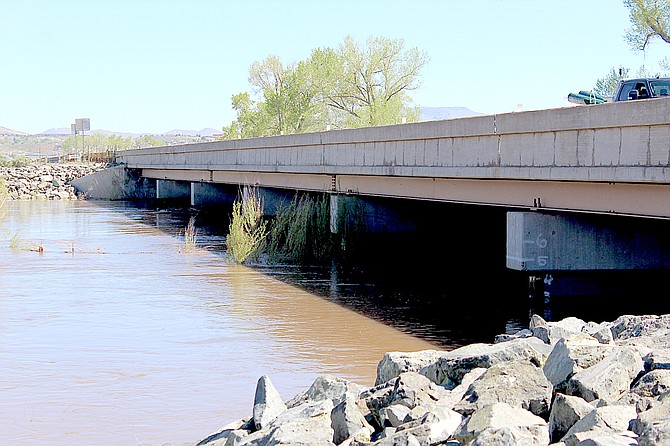
The Carson River is fairly placid at Cradlebaugh Bridge on Thursday morning.
Photo by Kurt Hildebrand.
A flood watch beginning Thursday evening for much of Western Nevada, including the Carson and Walker rivers.
The watch is expected to expire on Monday night, forecasters said on Wednesday.
“The current period of unseasonably warmer temperatures will result in excessive snowmelt and runoff from higher mountain areas into lower elevation locations along the Carson River, Walker River basins and eastern Sierra Basins,” forecasters said. “Creeks, streams and main stem river areas will continue to run high, fast and cold after expiration of the watch.”
The West Fork of the Carson River reached minor flood stage at Woodfords for three days this week, leading to the closing of Mottsville Lane for water over the road on Wednesday.
The river is forecast to crest at 14.2 feet early Sunday morning.
The East Fork is forecast to crest at 14.4 feet 5 a.m. Monday. It crested at 13.11 feet 3:55 a.m. Wednesday.
Both forks oscillate with troughs during the day and crests at night as the snow melts in the Sierra.
On Wednesday, Douglas County urged residents to prepare for potential flooding.
Residents should be prepared for potential road closures. Get the most up-to-date information on road closures and flood updates by following the County on Facebook, Twitter, Instagram, and Nextdoor.
Douglas County offers the following tips and resources:
GENERAL TIPS
• If you approach a flooded road, path, or walkway follow this rule: Turn Around, Don’t Drown.
• Driving through flooded roadways can be deadly.
• As few as 12 inches of moving floodwater can be enough to float and carry away a small vehicle.
• Six inches of moving water can knock an adult off their feet.
• Driving through 6 inches of standing water can cause vehicles to lose control and stall. Avoid flooded roads.
• Be aware of areas where water has receded. Roads may have weakened could collapse under the weight of a vehicle.
• Even a small amount of floodwater can hide dangers such as road collapse and debris.
EVACUATION
While there are currently no evacuations in place due to flooding in Douglas County, keep these tips in mind to stay prepared should an evacuation happen:
• Sign up for Douglas County Reverse 911 here.
• Prepare for a flood by knowing your evacuation routes, how you will get there, and where you will stay.
• Get your “go bag” ready today in case you need to leave quickly due to a flood.
• If authorities advise or order an evacuation, do so immediately. But, do not enter floodwaters in order to evacuate.
• If flooding is imminent or occurring, evacuate to higher ground if you are in a flood prone area. But, do not enter floodwaters in order to seek higher ground.

Comments
Use the comment form below to begin a discussion about this content.
Sign in to comment