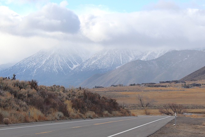
Clouds obscure the top of the Carson Range from Jacks Valley Road on Friday morning. It was sunny in parts of the Valley while flurries were falling in the northwest corner.
The storm door is definitely open. The only question is what sort of weather will waft through?
“What looks like the most significant and impactful storm of the winter season so far is knocking on our door,” National Weather Service Meteorologist Brittany Whitlam said on Friday morning. “Plan on major travel impacts in the Sierra from Sunday through Tuesday due to heavy snowfall.”
Unlike the most recent storm which arrived from the north, the next one appears to be coming from the south, with Mono County taking the first hit before sunrise before the storm extends north to Alpine County and Lake Tahoe before arriving in Western Nevada by mid-morning.
“This storm enters from the south, with a ‘hose’ of sub-tropical moisture initially aimed directly at the high Sierra in Mono County,” Whitlam said. “Probabilities show this ‘hose’ sweeping northward throughout the day on Sunday, before dropping southward again on Monday.”
The question is how long the hose will be pointed at Tahoe. Forecasters are revising the snow totals downward because it might be shorter than originally thought.
Around a foot of snow is forecast for the Tahoe Basin with as much as an inch down to the Valley floor.
“While snow totals have dropped a bit, travel in the Sierra will still be difficult to impossible, especially considering the window of heaviest snowfall will impact the Sunday afternoon ski commute and Monday morning commute,” Whitlam said.
Previous Story
After some disappointing fronts, forecasters say a storm coming on Sunday could make up for some lost ground.
“This storm remains on track to be the biggest storm of the season, so far,” said National Weather Service Reno Meteorologist Edan Weishahn on Thursday afternoon. “Plan on major impacts to travel in the Sierra with upwards of 3-plus feet along the Sierra crest from Sunday into Tuesday.”
Weishahn said the best time to travel this weekend will be on Saturday.
“Once it begins snowing, especially in the Sierra, then where you're at is likely where you'll be staying,” she said.
Unlike the most recent storm which arrived from the north, the next one appears to be coming from the south, with Mono County taking the first hit before sunrise before the storm extends north to Alpine County and Lake Tahoe before arriving in Western Nevada by mid-morning.
The main moisture push with highest accumulation rates (mostly snow, but maybe a rain-snow mix for the lowest valleys) appears to slide in from late Sunday afternoon through Monday morning, which isn't great news for the ski commute Sunday and the morning commute Monday,” Weishahn said.
There’s a possibility snow won’t be limited to the mountains with the foothills above 5,000 feet having a 50-70 percent chance of up to a foot of snow from Sunday to Tuesday.
The forecast calls for 1-3 inches of snow in Carson Valley, but that could vary wildly depending on microclimates.
For the current storm, the rain shadow effect kept precipitation light, with Heavenly Ski Base only reporting an inch of rain as of 6:24 a.m. Thursday.
That contrasts with a spot six miles west of Truckee that received 10.6 inches of snow, and Mount Rose Ski Base, which got 6 inches, according to figures released by the National Weather Service in Reno.
“Snow totals, so far, through this morning were around a foot along the crest and the Western slopes of the Sierra with low amounts on the east side,”
January didn’t provide much new moisture either in the Sierra or the Valley. Minden recorded .74 inches during the month, almost a full inch short of average 1.7 inches, and less than an eleventh of last January’s record 8.33 inches.
Snow telemetry at Carson Pass indicated there was 9.4 inches of water locked into the snowpack on Feb. 1, half the median 20.6 inches, according to the Natural Resource Conservation Service. Ebbetts Pass at the top of the East Fork of the Carson River had 11.1 inches down from the 22-inch median.

Comments
Use the comment form below to begin a discussion about this content.
Sign in to comment