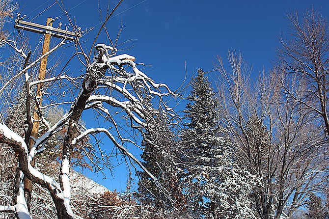
Snow sticks to a gnarled plum tree under blue skies on Sunday morning.
Photo by Kurt Hildebrand.
After what’s forecast to be a breezy Tuesday, a sequel to Saturday’s storm is predicted to arrive on Wednesday.
“This midweek storm appears to have several similarities to last Saturday's storm,” said National Weather Service Reno Meteorologist Mark Deutschendorf. “A period of stronger winds will precede the onset of the main snow during the mid morning-early afternoon, with potential for peak gusts of 45-plus mph for lower elevations, 60-plus mph in wind prone areas, and near 100 mph for Sierra ridges.”
The storm is expected to arrive from the north on Wednesday and quickly spread south, with a chance of snowfall rates of 1-2 inches an hour in time for the evening commute.
“Heavier weekday traffic would further aggravate the potential for long delays and even a few highway closures,” Deutschendorf said. "Projected snowfall amounts are also in a similar range as last Saturday, with most likely scenarios bringing 6-12 inches for the Tahoe basin southward to Mono County, 10-18 inches near the crest and 1-4 inches for much of Western Nevada."
Drier conditions and winds could bring a chance of white-out conditions, mainly in the Sierra.
10:30 a.m. Sunday update
Heavenly Mountain Resort reported receiving a foot of snow at the base over the course of the storm, according to snow totals released at 10 a.m. Sunday by the National Weather Service.
Kingsbury Grade received 8 inches during the same time frame, while a trained spotter near the Fay Luther Trailhead off Foothill Road reported 7 inches.
Road controls for Highway 395 through Carson Valley remain in effect this morning.
Jacks Valley Road has been plowed.
6 a.m. Sunday update
Chains or snow tires are being required on Highway 395 from Carson City south to Bridgeport and on 208 from Holbrook to Yerington this morning.
Anyone venturing into the mountains should be prepared to chain up if they don’t have snow tires and four-wheel drive.
Minden-Tahoe Airport’s automated weather station recorded snow over the course of seven hours on Saturday started 12:30 p.m.
Snow telemetry at Heavenly Valley indicated 8 inches of snow fell containing .7 inches of moisture.
Genoa received 6 inches of snow over the course of 18 hours.
Fredericksburg resident Jeff Garvin reported 4 inches of snow and a temperature of 1 degree.
A resident near Carson Valley Golf Course said Sunday that 5 inches of snow fell at their home.
The storm brought freezing temperatures to Carson Valley with the airport station dropping down to minus 6 degrees at 5:15 a.m. today.
“While the snow and strong winds have ended, the travel impacts were significant not just in the Sierra but the urban areas of far Western Nevada as well, due to the intensity of the snow on Saturday afternoon followed by a rapid clearing and cooling that made roads an icy mess,” National Weather Service Reno Meteorologist Mark Deutschendorf said.
Motorists should expect slick conditions through the day as high temperatures struggle to climb above freezing.
Deputies and East Fork medics responded to a report of a vehicle off Cradlebaugh Bridge early Sunday morning that turned out to be hunters parked by the river.
Sunday and Monday weren’t anticipated to see much addition to the snow, though with a high temperature of 32 degrees forecast, much of what fell on Saturday may stick around.
Temperatures could plunge back down into single digits or colder tonight.
A blustery cold front on Tuesday could see winds faster than 50 mph in Carson Valley and a little more snow in the mountains.
“A stronger and colder storm is then on track to drop southward into Western Nevada from Wednesday to Wednesday night,” Deutschendorf said. "This could be a similar event to Saturday's storm, with a short round of strong winds followed by bursts of heavier snow."
Wednesday's storm is expected to be drier than Saturday's.
"Although this storm appears to have more of a trajectory overland with liquid precipitation totals a little lower," Deutschendorf said, "the forcing from this low and cold front remain sufficient to produce additional snow with at least a 50 percent probability of 6 or more inches in the Tahoe basin southward to western Mono County, a foot or more along the Sierra crest, and plenty of winter travel hazards at all elevations into the Thursday morning commute.”
4 p.m. Saturday Update
Chain controls have been implemented over Kingsbury Grade and Spooner Summit, in addition to Highway 28, Highway 50 over Echo Summit, Highway 88 over Carson Pass and Interstate 80 over Donner Pass as near blizzard conditions arrived in Western Nevada.
Light snow started falling in western Carson Valley just before noon and was starting to accumulate around 1 p.m.
NV Energy workers were dealing with a downed pole near Jacks Valley Road near Ascuaga’s Ranch that affected 22 customers, according to NV Energy.com.
A spot between Mottsville and Centerville lanes in Carson Valley recorded a 71 mph wind gust at 10 a.m. Minden-Tahoe Airport had a 55 mph gust.
Winds of up to 45 mph were reported by Fredricksburg resident Jeff Garvin on Saturday morning.
Previous Story
Wind and winter weather advisories have been issued for Carson Valley by the National Weather Service.
Southwest winds of 20-25 mph, gusting to 50 mph are possible for Western Nevada between 8 a.m. and 3 p.m. today.
Snow accumulations of 1-3 inches in the Valley and 3-6 inches in the foothills are also possible between 3 p.m. and midnight today.
A winter storm warning for Lake Tahoe takes effect 7 a.m. today and will last until 4 a.m. Sunday.
“The first significant winter storm for this season arrives today and tonight with periods of strong wind gusts, heavy Sierra snow, light to moderate snow accumulations into Western Nevada, and the coldest air so far this winter,” said National Weather Service Reno Meteorologist Mark Deutschendorf early this morning. “Expect plenty of travel impacts (both aircraft and road) today and into tonight and consider postponing travel until Sunday when improved conditions are expected.”
Winds are expected to pick up this afternoon with some wind-prone spots gusting to 60-70 mph.
Previous Story
A cold winter storm is forecast to arrive in Carson Valley on Saturday, bringing the possibility of snow, according to the National Weather Service in Reno.
A winter storm warning has been issued for 7 a.m. Saturday to 10 a.m. Sunday in the Sierra around Lake Tahoe, including the Carson Range overlooking the Valley.
“Winter may have taken longer than usual to materialize, but the weather pattern from today into mid-January will certainly bring a reminder that winter is back and staying for a while,” said National Weather Service Reno Meteorologist Mark Deutschendorf. “Several storm systems are projected to move across eastern California and Western Nevada, with the coldest air mass of the season dropping snow levels to all valley floors.”
Deutschendorf said this weekend’s storm will be the biggest snow producer, so far this winter.
A relatively fast-moving storm, peak snowfall rates will be 8-12 hours in the Sierra and 3-6 hours in the Valley.
“However, winds ahead of this main snow area and lighter snow showers with chilly conditions behind it after will make difficult for the bulk of the weekend,” he said.
Winds will pick up by early Saturday morning with gusts near 100 mph over the ridges. Winds will drop into the Valley around 10 a.m. with westerly crosswinds on highways 395 and 88 seeing gusts of 40-60 mph.
Cold air in the Valley could bring snowfall of up to 2 inches with a chance of 6 inches in the foothills.
“For several communities including Reno-Carson City, this will be the first snow of the season, so have your vehicle ready for winter driving conditions, and drive with extra caution — slow down, avoid sudden turns and stops, and leave plenty of extra distance between vehicles if planning to be on the roads Saturday-Saturday night.”
Deutschendorf said relatively mild temperatures experienced over the past few weeks will make temperatures seem colder.
“Expect the coldest temperatures so far this season Sunday into Monday with highs barely getting above freezing Sunday in even the warmer valleys and north winds adding to the chill,” he said. “Overnight lows will plunge into the teens and single digits for ‘warmer’ areas and below zero in colder Sierra valleys.”

Comments
Use the comment form below to begin a discussion about this content.
Sign in to comment