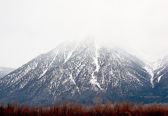
The Carson Range was obscured by clouds as a new storm arrived on Friday morning.
There isn’t much wet in the winter weather arriving this afternoon, but there might be a little.
Minden could see up to half an inch of rain and almost an inch of snow over the weekend, starting this afternoon, according to the National Weather Service in Minden.
Also scant in the forecast? Sunshine. Sky cover is predicted to be above 75 percent until Easter afternoon.
A winter weather advisory goes into effect this morning through 5 p.m. Sunday for most of Western Nevada, including Carson Valley.
Most of the weather will be above 6,000 feet where snow accumulations are predicted to hit 8-14 inches. Between 5,000 and 6,000 feet 3-6 inches are possible, with light overnight snow accumulating in the valleys which will turn to rain during the day.
There’s always wind, and the Valley could see gusts of up to 35 mph at times.
A winter storm warning for the Sierra, including Stateline, Glenbrook and Markleeville is in effect through 5 p.m. Sunday bringing 8-18 inches with it and up to 30 inches along the Sierra crest if the forecast holds.
“For Sierra communities from Mono County to the Tahoe Basin, the probability of exceeding 12 inches is below 30 percent,” said National Weather Service Meteorologist Hector Crespo on Friday morning. “For Western Nevada Highlands and hills the probability of exceeding 6 inches through Sunday is 20-50 percent, and up to 20 percent for amounts greater than 12 inches.”
Once the storm is past drier and warmer conditions will return for a few days before April showers put in an appearance over the second half of the week.

Comments
Use the comment form below to begin a discussion about this content.
Sign in to comment