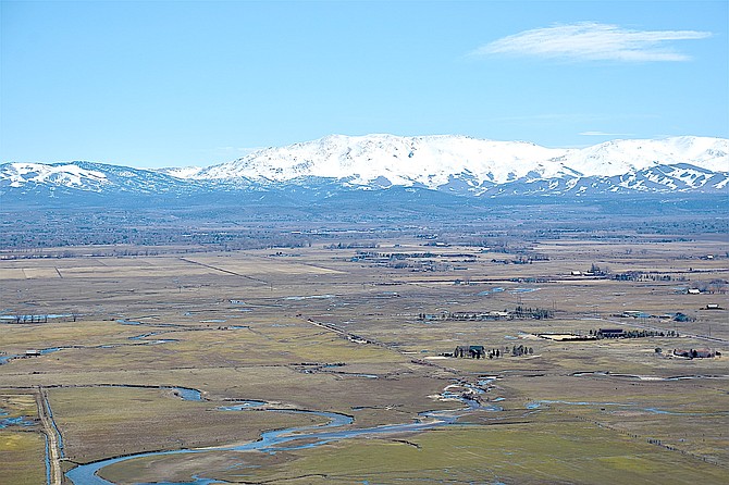
Carson Valley spread out on Sunday with the Pine Nuts white with snow in the background.
Tim Berube | Special to The R-C
A winter storm warning has been issued for the Sierra Nevada including Stateline and Lake Tahoe, with 8-16 inches of snow starting around 5 a.m. Tuesday.
“Heavy snowfall could generate problems for Sierra communities where snow load is still a concern,” National Weather Service Reno Meteorologist Dawn Johnston said on Sunday. “The colder nature of this storm and the high snow-to-liquid ratios will allow snow to be blown around, lowering visibility even more during heavier bands of snowfall.”
Forecasters are urging people to avoid travel over the Sierra if possible during the storm.
Carson Valley was on the southern edge of a backdoor cold front that backed up against the Carson Range early Sunday morning.
That brought heavy banded snow to areas northeast of the Sierra, including 9.3 inches in the Virginia City Highlands and 8 inches in Yerington.
A Gardnerville resident reported 3.5 inches of snow fell on Sunday morning, on the high end of the forecast.
A spot three miles east of the Gardnerville Ranchos received 2.8 inches, according to reports to the National Weather Service in Reno.
Minden weather watcher Stan Kapler reported 2 inches of snow as did Fredericksburg resident Jeff Garvin.
There’s more snow in the forecast starting early Tuesday morning as a new storm rolls into Western Nevada.
“This will be a colder storm with snow levels close to the lower valley floors,” forecasters said on Sunday afternoon. “Precipitation will be showery across Western Nevada with best chances for spillover late Tuesday as the front passes.”
Forecasters said the snow expected on Tuesday won’t be much more than fell on Sunday in Carson Valley.
“Accumulations will generally be 2 inches or less, but higher amounts are possible in the foothills,” according to the statement. “The late March sun angle will limit accumulations on most road surfaces in lower elevations.”
While there won’t be much snow, there will be some wind with the storm.
“Gusty south to southwest winds will precede and accompany the main cold front,” forecasters said. “Widespread wind gusts of 35-45 mph in valley locations will likely bring difficulties for high profile vehicles, aviators, and boaters.”

Comments
Use the comment form below to begin a discussion about this content.
Sign in to comment