Snow is flying near Double Spring Flat in the mountains south of Gardnerville on Sunday morning.
A winter storm watch was canceled 5 a.m. Monday and replaced by a winter weather advisory beginning 2 a.m. Tuesday as a storm arrived with warmer conditions than originally forecast.
“Heavy rainfall is expected Monday with snow accumulations possible above 6,500 feet,” according to the advisory. “Minor snowfall is possible late Monday afternoon, but accumulations are expected to be light. The main period for accumulating snowfall is between 2 a.m. and noon Tuesday.”
Rain was falling across Carson Valley with Fredericksburg resident Jeff Garvin reporting .76 inches as of 6:40 a.m. Genoa received around .3 inches by around the same time on Monday.
"Snow levels will vary widely Monday so the primary impacts will be winter
travel in the Sierra and minor urban and small creek flooding risks in the lower elevations," National Weather Service Reno Meteorologist Dawn Johnston said at 5:10 a.m. Monday.
With snow levels climbing to 7,000 feet, Carson Valley is going to be soupy today with chances of water ponding in urban area, and rises on small streams and the Carson River, Johnston said.
Forecasters are predicting 1-3 inches of snow down to the Valley floor on Tuesday morning with 3-6 inches above 5,000 feet.
Previous Story
“Snow levels will start at all valley floors early Monday,” forecasters said in a statement issued 4:15 a.m. Sunday. “They are expected to rise to 5,500-6,500 feet for a time on Monday afternoon and evening before falling back to 4,000-5,000 feet through Tuesday.”
A winter storm warning is in effect through 4 a.m. Wednesday at Lake Tahoe and the Sierra with 4-12 inches of snow expected at Lake level and 8-24 inches above 7,000 feet.
Parts of the Sierra crest could see more than 5 feet of snow with winds blowing 100-160 mph.
Temperatures will be the key in determining whether precipitation falls as rain or snow on Monday.
“Snow levels look to abruptly rise to 7,000- 8,000 feet from 9 a.m. to around 4 p.m. Monday,” National Weather Service Reno Meteorologist Dawn Johnston said on Sunday morning. “Areas below 7,000 feet will see heavy rainfall during this period.”
That rain and the snow already on the ground could lead to flooding in the Valley below 6,000 feet.
“Urban, small stream, and poor drainage flooding is likely Monday afternoon into Tuesday,” Johnston said. “Mainstem river flooding is still also a concern, but uncertainty is high due to snow level uncertainties.”
Johnston said there will be noticeable rises on the Carson River with avalanche and snow load concerns in the mountains due to heavy rainfall followed by snow on Tuesday morning.
The East Fork of the Carson River at Horseshoe Bend is forecast to crest at 11.7 feet 2 a.m. Tuesday, short of the 13-foot action stage, according to the Weather Service’s Advanced Hydrologic Prediction Service. The West Fork at Woodfords is forecast to crest at 10.5 feet, far short of action stage. Those will combine for a crest of 6.3 feet on the main stem of the Carson River just south of Prison Hill 4 p.m. Tuesday.
Forecasters said there’s a chance that most of Monday’s precipitation will fall as a snow in the valleys.
“Because of this uncertainty and variation of snow levels, urban and small stream flooding will remain possible in the lower valleys, especially where there is poor drainage from current debris and snowpack,” according to the watch. “The severity of flooding will be highly dependent on the variation of snow levels and precipitation rate during this time.”
Douglas County urged residents and businesses to take stock of their storm plans during the break in the storm.
“Avoid unnecessary travel and have emergency plans in place in case of power outages, flooding, and dangerous snow conditions,” county officials said. “Residents with children that need formula, diapers, or other essential supplies are encouraged to purchase these items in advance of the storm.”
The county has placed its warming stations on standby should there be a repeat of the New Year’s weekend outages.
An updated list of warming centers is available at douglascountynv.gov.
Snow fell in the mountains early Sunday morning with another storm arriving in Western Nevada.
NVroads.com traffic cameras showed snow flying at Daggett Summit and at the midway point on Kingsbury Grade where chains or snow tires were required with four-wheel drive.
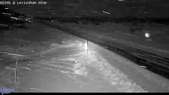
The traffic camera at the intersection of Leviathan Mine Road and Highway 395 also showed snow. Chains or snow tires were required for the stretch of highway through the Pine Nuts south of Gardnerville as of 6 a.m.
CalTrans has closed the highway from Bridgeport south due to near white-out conditions.
There’s a chance of rain and snow today in the Valley until 7 a.m. with the snow level at 5,200 feet. Expect clearing skies today with a high temperature near 42 degrees and southwest winds 10-15 mph, gusting to 25 mph.

Comments
Use the comment form below to begin a discussion about this content.
Sign in to comment