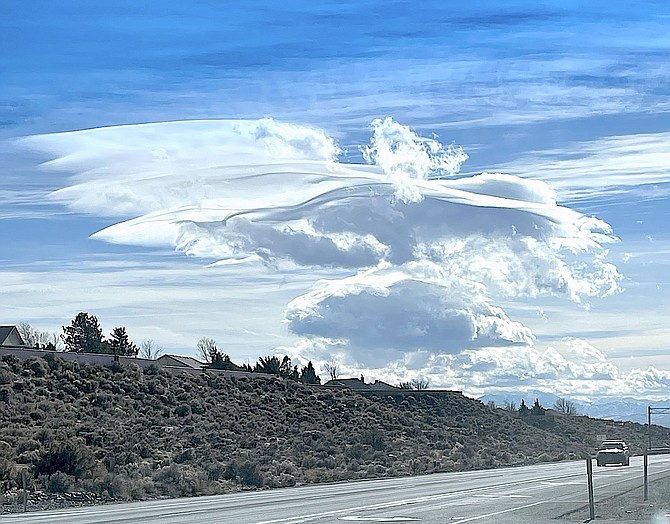
A cloud that resembles an angel hovers over Carson Valley on Monday as seen from Indian Hills. Photo special to The R-C by Archie Walker.
A winter weather advisory has been issued for Carson Valley from 4 p.m. Thursday to 4 a.m. Friday.
The advisory was issued 2:03 p.m. Tuesday.
“Snow expected (with) total snow accumulations up to 2 inches, except 2-6 inches in foothill locations near and above 5,000 feet.”
Forecasters are alerting motorists that they may experience slick roads Thursday night and Friday morning.
“Snow may begin to accumulate Thursday afternoon in foothill locations, but the greatest risk for snow accumulations at all elevations will occur Thursday evening and overnight,” forecasters said. “Even though the snow is expected to wrap up before the Friday morning commute, the roads may still be icy.”
A wind advisory has been issued for 7 a.m. to 4 p.m. Thursday with gusty winds of 15-25 mph, gusting up to 45 mph. Wind prone areas may see gusts of up to 60 mph.
“Gusty winds could blow around unsecured objects,” forecasters said. “Tree limbs could be blown down and a few power outages may result.”
Previous Story
Monitor Pass will close at noon Wednesday in preparation for a forecast storm expected to arrive early Thursday morning.
A winter storm watch was issued on Monday afternoon for the greater Lake Tahoe area, including Stateline, by the National Weather Service in Reno.
The forecast calls for 14-26 inches of heavy snow above 7,000 feet, mostly along the Sierra crest, where wind gusts of more than 100 mph are expected.
At lower elevations at Lake Tahoe snow totals could reach 10-16 inches with 45 mph wind gusts.
“A pair of stronger winter storms Thursday through the weekend will bring periods of gusty winds and heavy mountain snow,” forecasters said. “Travel through the Sierra will become hazardous at times with accumulating snow possible even on the lower valley floors.”
Wednesday’s storm appears to be the strongest this week with some atmospheric river moisture adding to the potential, with 40-55 mph gusts and 60-70 mph gusts in wind prone areas.
“Eventually, enough cold air will filter in to change the rain to snow during the latter stages of this storm, most likely for Thursday late afternoon and evening,” said Reno Meteorologist Mark Deutschendorf.
There’s a potential for several inches of snow in the foothills with up to 2 inches for the valley floors.
Another storm is expected to arrive overnight on Saturday bringing a chance of measurable snow to the Valley should several things align.
A weak storm system brought gusty winds and some light cloudiness on Monday. A wind gauge at the Fish Springs Fire House recorded a 47 mph gust at 3:53 p.m. Monday. Minden-Tahoe Airport recorded a 28 mph gust around 2:15 p.m.
Total precipitation in Minden for November was .87 inches as of Tuesday, with 7.2 inches as snow. While above average, the month has been a middling moisture producer.

Comments
Use the comment form below to begin a discussion about this content.
Sign in to comment