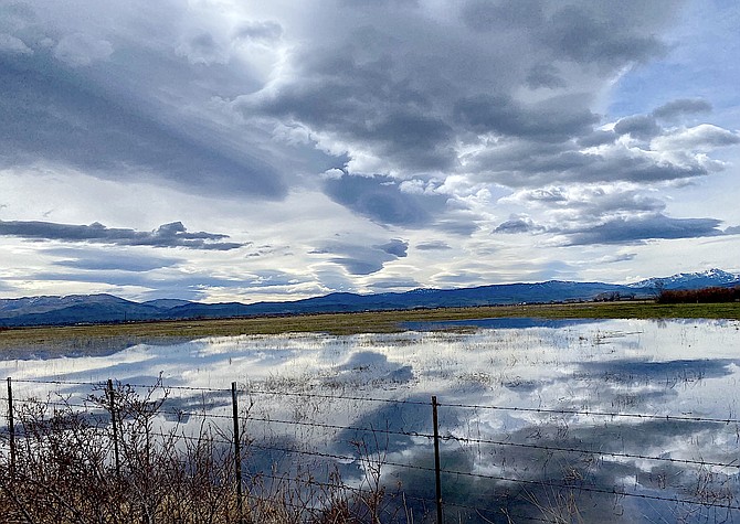
Storm clouds are reflected in a flooded field in Carson Valley on Friday afternoon. Photo special to The R-C by Katherine Replogle
Tonight is forecast to be a wild one with southwest winds 30-45 mph, and gusts of more than 40 mph along the Highway 395 corridor.
“There will be a chance for wind prone areas to exceed 60 mph,” National Weather Service Reno forecasters said in a statement. “Patchy blowing dust will also be possible downwind of sinks and dry lake beds Monday afternoon and evening.”
A wind advisory takes effect 2 p.m. today and will last until 11 a.m. Tuesday. Forecasters urged residents to prepare for possible power outages.
A winter weather advisory has been issued for the Lake Tahoe area above 6,500 feet 2-11 a.m. Tuesday.
Forecasters are anticipating the storm won't be very wet, with less than 2 inches of snow forecast at Lake level.
However, there’s more hope that colder, wetter weather will arrive Wednesday through Friday bringing precipitation totals of more than 2 inches across the Sierra.
“Snow levels should remain below pass levels through the duration of the event,” forecasters said on Sunday morning. “Snowfall totals may exceed 2 feet in higher elevations, 8-14 inches at Lake Tahoe level. Several inches will be possible in the foothills of Western Nevada, but more uncertainty exists in these areas.”
A mild Easter provided a break from a string of spring storms.
Saturday’s storm brought a 79 mph wind gust 6 a.m. near the base of Kingsbury left 5 inches of snow at Heavenly Stagecoach.
A rain gauge north of Genoa recorded .38 inches of rain 7-10 a.m. Saturday, while a gauge further south near Fredericksburg had .28 inches.
Markleeville recorded .64 inches of precipitation and South Lake Tahoe recorded .45 inches, according to National Weather Service observations.
Cooler temperatures and some additional moisture resulted in the snow water equivalent at Ebbetts Pass, which feeds the East Fork of the Carson River, recovering slightly from a low of 10.1 inches on April 11 to 13.2 inches on Sunday.
Snow telemetry operated by the Natural Resources Conservation Service showed the snow water equivalent at Carson Pass going from 7 inches on April 11 to 8.2 inches on Sunday. Carson Pass is at the top of the West Fork.
Previous story
Slick conditions on Kingsbury Grade resulted in at least three spin-outs around 8:15 a.m. Saturday morning, including a sheriff’s patrol car.
A black Porsche sport utility vehicle was reported into the guardrail as snow began to stick to the highway.
Road controls went into effect over Kingsbury and Spooner Summit 7:30-8 a.m. The deputy warned other drivers of slick conditions in the S-curves approaching Daggett Summit as another spring storm arrived in Western Nevada.
There was no report of serious injuries.
A winter weather advisory is in effect for the Greater Lake Tahoe region until 2 p.m. Saturday with snow accumulations of up to 4 inches around the Lake.
“Travel could be very difficult,” forecasters said. “Very strong winds could cause extensive tree damage.”
A gauge a mile north of Genoa recorded .28 inches of rain over the course of an hour, as it continued to pour.
The forecast calls for the rain to clear by lunchtime.

Comments
Use the comment form below to begin a discussion about this content.
Sign in to comment