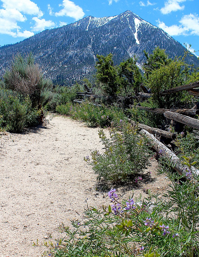
Flowers bloom along the Jobs Peak Trail on Wednesday afternoon as the trails namesake rises above it.
Photo by Kurt Hildebrand.
Work on the original comprehensive trails plan coincided with the creation of the Jobs Peak Trail up from Foothill Road to U.S. Forest Service land.
There were trails that preceded that in 2003-4, but not quite the 1,000 miles of trails across Douglas County today.
Sunday was the last day to participate in an online survey at https://bit.ly/44xrBho, but there will be other opportunities for residents to provide some input into the plan.
“This is our public outreach campaign,” Community Services Director Scott Morgan told members of the Gardnerville Town Board. “The worst thing we want to happen is for someone to tell us that ‘I had some ideas, but no one listened, and no one gave me an opportunity to speak.’”
Morgan said that trails are residents’ favorite amenity.
“There are lots of other nice things like parks and community centers, but the one thing that consistently adds value is open space and trails,” he said. “Trails are the No. 1 characteristic that most people desire in a recreation element in the county.”
By far the largest portion of trails in the county are for off-highway vehicles, mostly in and around the Pine Nut Mountains.
However, there are 181 miles of nonmotorized trails in the county ranging from the mountain trails in the Sierra from Jacks Valley to Fay-Luther and more urban trails, like the nearly five-mile Martin Slough Trail that opened last summer.
“For those who have been in the county for a while and seen plans come and go, one key characteristic to the ones that have succeeded has been community involvement and outreach,” Morgan said.
Wood Rogers Principal Planner Derek Kirkland said they’re piecing together previous work and data and building a new plan and maps.
“We’re out to get as much feedback as we can before release those maps through the public workshops and continuing to meet the stakeholders,” Kirkland said. “There is definitely a lot of interest in trails in Douglas County. It’s a wonderful place.”
The work includes several goals including exploring how different users use the trails and looking for ways to close the gap between activities and benefits.
“We don’t want to just create the plan, we want to create a plan with an implementation portion and talk about operations and maintenance as well as user safety,” he said.
One of the more ambitious proposals supported by both the Gardnerville Ranchos and Gardnerville boards was a trail connecting the county’s largest population center with amenities, including Lampe Park and the Douglas County Community & Senior Center, in Gardnerville.
Estimated to cost around $6 million, work on the trail is complicated by having to cross the East Fork of the Carson River.
According to the county, the 10-foot paved trail would be nearly 10,000 feet long and would include a pedestrian bridge over the river, since Lutheran Bridge is barely wide enough for motor vehicles.
After the survey is complete and the plan has been presented to the Parks and Recreation Advisory Board on July 11, four public workshops are scheduled for portions of the county.
Residents will be able to attend a workshop 11 a.m. to 1 p.m. July 25 at Kahle Community Center in Stateline. Another workshop is scheduled 4-6 p.m. that day at the Indian Hills General Improvement District meeting room at James Lee Park.
South County residents are invited to a workshop 10 a.m. to noon July 27 at the Topaz Ranch Estates Community Center. The final workshop will be 3-6 p.m. at the Douglas County Community & Senior Center in Gardnerville.
Douglas County is not alone in planning trails.
Neighboring Alpine County is working on the Eastern Sierra Towns to Trails Plan that will identify a multi-use network that will connect Eastern Sierra communities to each other and to public lands throughout the region as well as to destinations south and north such as Lake Tahoe.
The project parallels the Eastern Sierra from northern Alpine County, just over the state line from Fay Luther Trail, through Mono County, and on into southern Inyo County, a distance of around 200 miles.
“The Trails Plan will build upon existing trail and soft-surface infrastructure in the region and will take advantage of existing priorities for trail connectivity already developed by federal land managers along with stakeholder ideas generated through the ‘Recreation Stakeholders’ track of the Sustainable Recreation and Tourism Initiative,” officials said.
“The planning process will feature county by county collaborative planning efforts that will include tribes, relevant land managers, stakeholders, and local agencies.”
A Zoom meeting on the project is 6-7 p.m. June 29. Registration for the meeting can be found at www.townstotrails.org

Comments
Use the comment form below to begin a discussion about this content.
Sign in to comment