Conditions were quiet on Thursday morning between two fronts.
A stormy Wednesday brought only the second public safety power outage in three years to 30 NV Energy customers north of Genoa.
While it was pretty clear that there was a storm coming, few people were prepared for the actual impact it had in the mountains.
Vehicles were stuck on Kingsbury Grade, including a semi as deputies tried to clear the road on Wednesday afternoon.
The Grade closed around 5:30 p.m. to get a snowplow and sand on the main route connecting Carson Valley and Lake Tahoe.
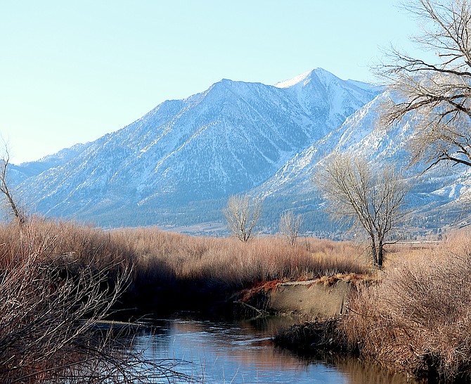
By 5 p.m. the rain had started to fall along the foothills and snow was piling up in the higher elevations, with up to 8 inches in Heavenly Valley from the storm, according to the National Weather Service.
The arrival of moisture slowed down the wind for the most part and NV Energy cleared the power outage at 5 p.m.
Previous Story
As of 11 a.m., two power company customers are listed without power at NVEnergy.com.
The power company announced on Wednesday morning that it was moving forward with a 10 a.m. public safety outage for about 30 customers in the north Genoa area based on the forecast for high winds.
Both of the Tahoe addresses list an outage time of 9:18 a.m. and no cause or time of restoration, so it’s not clear whether those outages are related.
At least one Genoa resident reported losing power around 10:10 a.m. just over a mile north of town.
Additional customers in south Genoa, Clear Creek and Jacks Valley will remain in a warning. Anyone who’s power is shut off because of the safety outage should not expect the power to be restored until 5 p.m. after workers check the lines.
In the first hour of a wind advisory issued by the National Weather Service, Minden-Tahoe Airport recorded a 40 mph wind gust.
In preparation for the coming storm Monitor Pass was closed 11 a.m. Wednesday, according to the California Department of Transportation.
Previous Story
NV Energy issued a public safety outage warning for Genoa residents as a result of windy weather forecast for Wednesday.
The alert is effective 10 a.m. to 5 p.m. as a wind advisory is in effect for 10 a.m. to 10 p.m. Wednesday.
The warning affects the region from Genoa north into Alpine View and the east shore of Lake Tahoe.
Previous story:
The Carson Valley inversion pinned smoke and haze to the ground on Tuesday morning, but a windy Wednesday should be sufficient to clear it out.
Air quality in the Valley dropped to 45 or just barely in the good range as of 8 a.m. in Minden.
In Johnson Lane, air quality decreased to the moderate range with a 60.
A wind advisory has been issued for Wednesday with strong winds along the Highway 395 corridor.
“By midday Wednesday, winds will begin to mix down to the lower valley areas with wind gusts in the 30-45 mph range for most locations,” said National Weather Service Reno Meteorologist Edan Weishahn. “Wind prone areas may experience wind gusts 45-60 mph in the afternoon. This initial system pushes through fast, so the duration of the stronger wind bursts shouldn't last for more than a few hours in the late afternoon-evening.”
Wind gusts are expected to exceed 100 mph along the Sierra crest.
There isn’t much precipitation forecast to accompany the incoming systems with a chance of 1-3 inches of snow around Lake Tahoe and perhaps as much as a half-foot in the Sierra peaks.
“The foothills in western Nevada may see a dusting Thursday, and snow levels may drop just low enough for a few snowflakes down in the lowest valleys, but generally it will be rain showers down here,” Weishahn said.
The odds are only 20 percent for up to 4 inches of snow on Carson and Ebbetts passes.
The two systems will leave cold weather in their wake.

Comments
Use the comment form below to begin a discussion about this content.
Sign in to comment