The National Weather Service in Reno has extended a flood advisory for south central Lyon County until 10:30 a.m. Thursday.
River gauges and local water management officials have indicated minor flooding continues along the East Walker River from just above Strosnider Ditch downstream to near the confluence with the West Walker River. Most of the flooding will be restricted to farm and ranch land near the river.
In Douglas County, high winds early Thursday morning knocked electricity out to thousands of Carson Valley residents.
According to NV Energy, nearly 2,900 Douglas County residents were without power starting around 5 a.m.
Eleven of those outages were in Gardnerville, where 2,608 residents were without power.
Two outages affected 208 Minden residents, and five outages affected 66 Stateline residents.
All but the Lake Tahoe residents had power restored by 7:30 a.m.
A 57 mph wind gust was clocked in central Carson Valley at 4:50 a.m. according to the National Weather Service. Minden-Tahoe Airport had a 54 mph wind gust.
The big gust on Thursday morning was at the Fish Springs Fire House which recorded a 58 mph gust at 6:33 a.m.
A high wind advisory is in effect until 4 p.m. today, with winds forecast to be 20-30 mph, gusting to 45-55 mph at times. So expect more outages through the day.
NV Energy told customers to expect multiple wind-related outages today.
“Our crews are working around the clock to clear the lines and restore our customers to power as quickly and safely as possible,” the company said.
It warned residents to call 911 if they come across downed power lines.
“If you encounter a downed power line, consider it live and very dangerous,” the company said. “Report any such lines to either 9-1-1 or NV Energy.”
Thursday morning's rain was the start of a first system with a second system Sunday into Monday. In addition to the rain, there would be a high wind watch in effect into today, with gusts reaching up to 70 mph.
Temperatures will stay about normal, meteorologist Brian O’Hara said, with highs in the 50s today but then dropping to the low 30s Friday and Saturday because of the wind and rain. Temperatures are expected to get back up to the 40s Sunday and Monday.
Even though it will be raining, O’Hara said Carson will see only a third of an inch of rain by Thursday and the storm Sunday and Monday will bring a half an inch of rain.
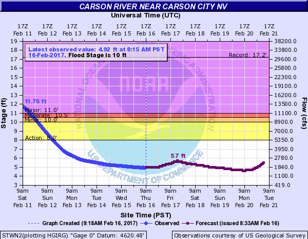
The National Weather Service is unsure of the trajectory of the storms, but they could bring a potential for renewed flooding and heavy mountain snow throughout the Sierras and western Nevada. However, there isn’t any expected renewed flooding for the Carson River, but river levels will take time to recede so the river will be higher and faster than normal flows throughout the week and residents should be vigilant of flash flooding in prone areas. The greatest potential for snow and flash flooding will be today, Friday and Saturday for the Sierra Range and western Nevada.
No major travel impacts are expected for today, however, snow could affect travel late Friday into early Saturday and Monday morning.
With all of this precipitation, the latest projections for the spring snowmelt favor 250 to 350 percent of normal April to July runoff. This is similar to the record snowmelt season in 1983, where the area saw prolonged river and stream flooding on nearly all basins for months, so meteorologists are suggesting to keep flood mitigations measures stocked through the spring.

Comments
Use the comment form below to begin a discussion about this content.
Sign in to comment