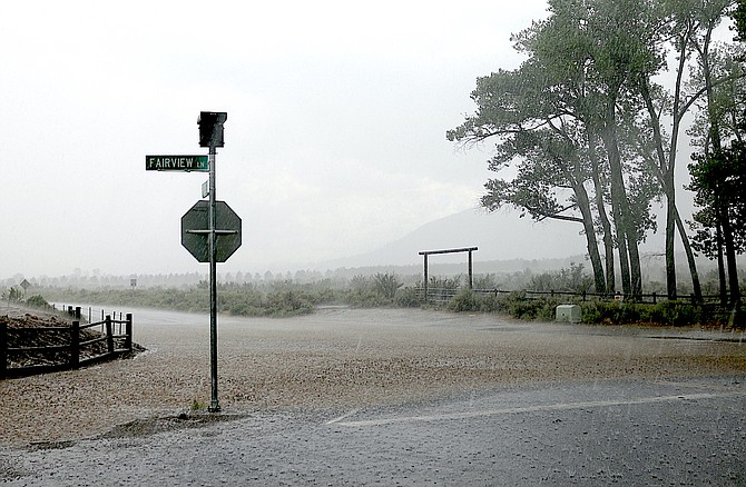
Raindrops splash on Fairview Lane at the intersection with Fredericksburg on Thursday afternoon as heavy rain fell in southern Carson Valley.
Photo by Kurt Hildebrand.
Even as people are digging out from last week’s thunderstorms, there’s a risk of more on the way Monday and Tuesday.
“Another surge of monsoon moisture will yield increased thunderstorm chances through Wednesday, with potential for heavy rainfall, flash flooding, and strong outflow winds,” forecasters said on Sunday.
A storm cell ran north along the Pine Nuts, but there was very little lightning on Sunday, as the chance of rain was relatively low at 5-15 percent.
“On Monday, those chances increase to 20-30 percent, with Tuesday seeing the most significant risk of storms at 40-60 percent probability,” forecasters said. “Another round of heavy rains from these storms is possible with simulations indicating potential for up to 1 inch per hour from any storms that develop. There`s even some risk of up to 2 inches per hour on Tuesday.”
The statement covers most of the Sierra eastern slope in addition to all of Western Nevada, including Mineral, Churchill and Pershing counties.
Forecasters advised that flash flooding could be particularly severe on the burn scars of the Tamarack, Caldor and Dixie fires.
“People living in flood prone areas or near these recent burn scars should monitor the forecast and be prepared to take action should heavy rains occur, or a flash flood warning be issued,” according to forecasters.
Most of the rain fell in the southern part of Carson Valley, with Genoa receiving .66 inches on Thursday and Friday.
Weather Service records indicate that the 2.57 inches of rain that fell in Minden on Thursday set a new record for both the day and the month. Another .14 inches fell on Friday.
Centerville resident Dave Benjamin reported 3.48 inches of rain fell.
“Along with enough hail to shred my vegetable garden and trees with tender leaves,” he said.
Fredericksburg resident Jeff Garvin reported 3.19 inches of rain and some minor flooding.
“A few sandbags and we’re good,” he said.
The previous record for the month of August was 2.38 inches in 1983. Records have been kept in Minden since 1906.
August has seen 2.73 inches of rain, bringing the total for 2022 to 3.49 inches. That’s still short of the average 5.99 inches by this time after an exceedingly dry winter.
For the water year, which started on Oct. 1, Minden reached 9.97 inches, or 112 percent of average if not another drop falls in the county seat before Sept. 30.
During 2021, both October and December were near record months, though the traditionally wet months of January through March only saw .38 inches of precipitation when they average 4.25.

Comments
Use the comment form below to begin a discussion about this content.
Sign in to comment