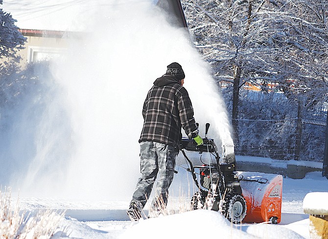
Snowblowers were operating across Carson Valley on Thursday morning after snow fell overnight.
Photo by Kurt Hildebrand.
A high wind warning has been issued for Western Nevada from 1 p.m. today through 4 a.m. Sunday, according to the National Weather Service in Reno.
“Damaging winds may blow down trees and power lines,” forecasters said early on Saturday morning. “Travel will be difficult, especially for high profile vehicles.”
Minden is expected to see southwest winds gusting up to 55 mph between 7 p.m. and midnight, according to the Weather Service.
Gusts may be higher along the Highway 395-88 corridor through Carson Valley. Sustained winds of 24-34 mph are expected into early Sunday.
With 21 inches of fresh snow and the gondola back in action, Heavenly should be ready for a big three-day weekend, though the wind will definitely get in the way through Saturday, at least.
For the third time in a week, a winter storm warning has been issued for Lake Tahoe until Sunday morning, with potential snow accumulations of 12-22 inches possible above 8,000 feet and high winds of 40-50 mph.
Travelers should be prepared for snow levels to start around 5,400 feet and climb to 6,500 feet this afternoon. Forecasters aren’t expecting much in the way of snow accumulation in Carson Valley.
The second winter storm of 2024 took its sweet time arriving in Western Nevada.
Severe weather conditions prompted Gov. Joe Lombardo to order all state executive branch offices in Western Nevada not essential for public safety closed on Thursday and Friday.
Lombardo ordered offices closed after reports from the Nevada Department of Transportation and the Department of Public Safety reports of dangerous road conditions.
The roads were slick top to bottom on Thursday morning after a combination of rain and snow on Wednesday, with road controls both at Lake Tahoe and across Carson Valley and the Pine Nuts.
There were a few Douglas County offices that experienced a delay in opening, but otherwise the county was out and about.
Fredricksburg resident Jeff Garvin reported 8.5 inches of snow on Thursday morning and 8 degrees.
Minden weather watcher Stan Kapler and Topaz Ranch Estates resident John Flaherty both reported 6 inches of snow fell.
The real snow fell out in the deserts with Lake Lahontan competing with Heavenly with 18 inches and 17.5 inches east of Fernley.
Carson City had 9 inches of snow fall on the west side.
Lyon County got socked by a snow squall with Dayton reporting 11 inches, the same for Smith Valley. The county shut down nonpublic safety offices on Thursday.
The snowpack in the Carson River Basin shot from 38 to 53 percent of average over the first 10 days of 2024.
According to Natural Resources Conservation Service, the snowpack was the seventh lowest since snow telemetry began in 1981 for both the Carson and Walker river basins.
The Walker Basin went from 44 to 56 percent of average. Topaz Lake is at 68 percent of capacity, which is significantly higher than the 24 percent on Jan. 1, 2023. Bridgeport Reservoir is at 84 percent, up from 30 percent on New Year’s Day 2023.
The Truckee River Basin is at 57 percent on Jan. 10.
Central Nevada benefitted from the recent storms, with the Humboldt River Basin at 104 percent if average and Central Nevada Basin at 97 percent.

Comments
Use the comment form below to begin a discussion about this content.
Sign in to comment