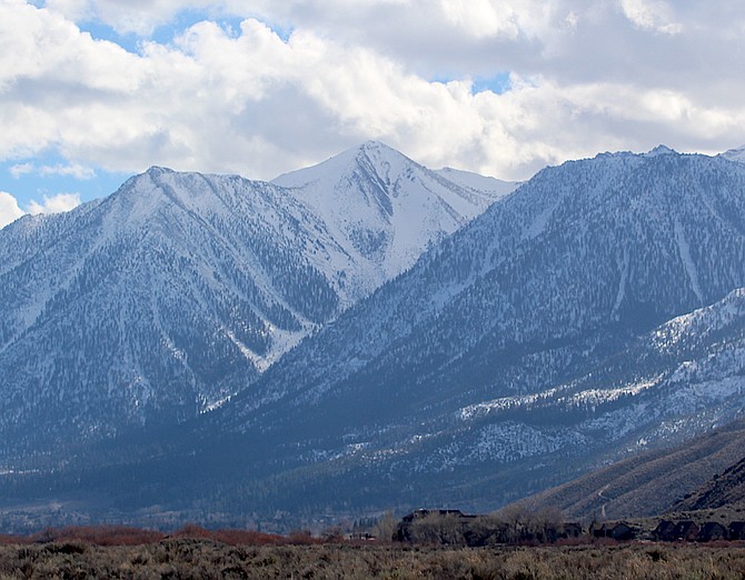
Clouds start to gather around Jobs Peak on Wednesday afternoon not long after a winter storm watch was upgraded to a warning starting Thursday night.
Blizzard conditions could close Kingsbury Grade as early as Friday night, according to the Nevada Department of Transportation.
“The coming major winter storm, anticipated snowfall rates, blizzard warnings, and staffing concerns, may cause NDOT to close Kingsbury Grade on the Carson Valley side,” NDOT District II Engineer Bhupinder Sandu said.
The state will do everything it can to keep all highways open, but motorists should anticipate the storm will close some of them.
A priority will be clearing Highway 50 on both sides of the Tahoe Basin, especially if the California Department of Transportation closes Interstate 80 at some point during the storm.
State transportation spokeswoman Meg Ragonese urged motorists to check nvroads.com for up-to-date information.
Douglas County shared an alert for the coming storm on its website at douglascountynv.gov.
“The National Weather Service is predicting heavy Sierra snow with blizzard conditions the evening of Friday through the morning of Saturday,” according to the alert. “Snow levels are expected to drop to valley floors Friday night.”
National Weather Service forecasters have issued a blizzard warning for the Sierra Nevada including Lake Tahoe and Mono County with high intensity snow and strong winds that could bring periods of whiteout conditions and near-zero visibility.
The warning takes effect for Tahoe 10 a.m. Thursday and in Mono County at 4 p.m. Thursday. Life threatening conditions are expected between Friday afternoon and Saturday morning in the Sierra.
A winter storm watch for Carson Valley was upgraded to a warning
10 p.m. Thursday through 10 p.m. Saturday.
As much as 9 inches of snow is anticipated to fall in Minden, with higher amounts possible in the Foothills.
“The well-advertised major winter storm will usher in widespread, strong winds and heavy snow Thursday into the weekend,” said National Weather Service Reno Meteorologist Wendell Hohmann on Wednesday afternoon. “Snow amounts for far western Nevada valleys have increased, and a Winter Storm Warning has been issued. The worst conditions (strongest winds and heaviest snow/most widespread blizzard conditions even into Sierra communities) will occur late Friday afternoon through midday Saturday.”
Alpine County issued a travel advisory on Wednesday afternoon.
“Travel is not recommended, and residents and visitors are asked to prepare in advance for heavy snow, rain, wind, dangerous road conditions and refrain from entering avalanche terrain.”
Gov. Joe Lombardo asked Nevadans to prepare for the storm.
“I strongly urge Nevadans to prepare for the significant winter storm approaching Northern Nevada,” Lombardo said. “This storm is expected to bring dangerous temperatures and conditions to our state, and it’s critical that Nevada families are prepared. As we coordinate preparedness efforts, my office is in communication with law enforcement, the Nevada Department of Transportation, NV Energy, and Nevada Division of Emergency Management-Homeland Security to maximize preventative measures and recovery efforts.”
Previous Story
A storm that could bring more than a half-foot of snow to Minden is forecast to arrive with the wind on Thursday
The National Weather Service issued a winter storm watch for Western Nevada, including Carson Valley starting 10 p.m. Thursday and lasting through Saturday.
The storm opens with a high wind watch starting 4 a.m. Thursday and lasting until 10 p.m. Friday.
“A storm that's impressive even by Sierra standards will arrive Thursday morning, with strong and potentially damaging winds along with increasing intensity of mountain snow during the day,” said National Weather Service Reno Meteorologist Mark Deutschendorf early Tuesday morning. “By late Friday night, a blast of cold air will lower snow levels to all valley floors, with periods of snow Saturday through Saturday night.”
Deutschendorf said there are some signs that snow could continue through Sunday night.
He said that snowfall amount probabilities are shifting to certainties. In the Sierra.
“Snow amounts will be so much and difficult to accurately measure due to strong winds producing prolonged periods of near zero visibility (with) blowing and drifting snow capable of burying vehicles and making it difficult to locate roads. Even walking outside would not be advised during this storm as a person could quickly become lost or disoriented.”
He said that odds are 60-70 percent that the Valley floor will receive more than 6 inches, and 15-30 percent that will be more than a foot.
The foothills at 5,000-6,500 feet will likely see more snow than the Valley floor, but how much depends on moisture and temperature.
“The amounts could vary from less than 1 foot to as much as 3 feet,” Deutschendorf said.

Comments
Use the comment form below to begin a discussion about this content.
Sign in to comment