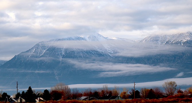
Hanging clouds are brushstrokes across the face of the Carson Range in mid-November.
Photo by Kurt Hildebrand.
After an admittedly slow start to the season, a lower end atmospheric river could arrive at the West Coast near the California-Oregon border next week.
While the weather pattern won’t have a significant effect in Western Nevada, it is forecast to bring precipitation down to the Lake Tahoe area, Reno Meteorologist Chris Smallcomb said at the California-Nevada Drought & Climate Outlook Seminar on Monday.
“We’ve had a little bit of a slow start, but nothing too anomalous,” he said.
Where a year ago, much of Nevada was in drought, only a small portion around Lake Mead in Southern Nevada remains in drought.
The record water year resulted in a record low number of red flag warnings last summer with five, according to Smallcomb.
“We didn’t have a lot of big smoky days,” he said. ‘Conditions have been good this fall for prescribed burning. The ground is moist, and it hasn’t been overly windy or hot.”
The effects of next week’s atmospheric river is expected to pass north of Western Nevada, Smallcomb said.
Between 1-2 feet of snow could fall in the Sierra Nevada at Donner with a 56 percent chance of more than a foot by Sunday morning.
The further south in the Sierra, the odds of a foot of snow drop to one in four with 8 inches of snow forecast near Mammoth Lakes.
“Snowfall dictates our water supply,” Smallcomb said. “In the grand scheme of things, 1-2 feet of snow is nice but not a major weather event.”
He said that while there aren’t any huge indications of impending moisture, there is a possibility.
“We’re not seeing any screaming signals, but the storm door remains ajar and we could see some weather events coming into that time frame.”
The big weather news this year is the El Niño that will likely last through the winter and may rival some of the biggest on record.
The strip of warm water in the Pacific tends to bring wetter conditions to the Southwest and warmer conditions to the Northwest, with Western Nevada sitting right in between the two patterns.
He said the models are leaning slightly toward a wetter winter, but that El Niño doesn’t necessarily translate to more precipitation for Western Nevada.
“You got your dice and your rolling them a little bit loaded toward a wetter outcome,” he said. “For the Sierra and Great Basin it looks snowier than average going into winter, but that’s not guaranteed.”
Forecasters are predicting a chance that snow levels will drop to the Carson Valley floor early Friday and again on Friday night.

Comments
Use the comment form below to begin a discussion about this content.
Sign in to comment