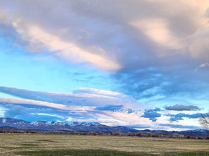
Lenticular clouds pass over Carson Valley on Tuesday in this photo by Pam Brekas.
On April 1, Natural Resource Conservation Service Hydrologist Jeff Anderson will visit the Mount Rose telemetry site to measure the snowpack and report on the status of the region's snowpack.
Last month, Anderson couldn't make it into the site because Mount Rose Highway was closed due to the Leap Day weekend storm that helped bring the snowpack up to median.
The word from weather experts at Monday’s Drought and Climate Outlook was “normal,” which was a darn sight better than the “snow drought” reported at the beginning of the year.
“Over the years, I don’t think I’ve ever had to say ‘normal’ so many times,” said Julie Kalansky of the Center for Western Weather and Water Extremes.”
That’s a big improvement over a snowpack that was at 33-50 percent at the beginning of January.
“The Sierra was still missing quite a bit of precipitation,” she said.
Storms in February helped significantly, and last weekend’s storm was a welcome boost after a warm dry spell through the middle of March.
Irrigation season begins on April 1 in Carson Valley, and the only major upstream storage is the snowpack in the Sierra.
Kirkwood Mountain Resort extended its season until April 28 after receiving 29 inches of snow in the week that ended on Monday.
Heavenly reported 13 inches at the base.
Natural Resources Conservation Service telemetry located at 8,533 feet showed 15 inches of snow added at Heavenly Valley over the course of 24 hours during the weekend.
“The main things for both California and Nevada is that we’re getting pretty close to normal after a slow start to the water year,” she said.
One thing the dry spell in the middle of March did provide was a clear look at the snowpack from satellite.
“There hasn’t been very many clear days all winter,” said River Forecaster Nathan Patrick. The dry part of March also saw some reduction of the snowpack.
“We may have made some of this up over the last day or two with the precipitation that came through,” he said.
While last winter’s record snowpack melted slowly due to cooler temperatures, that could change this spring.
Long-range forecasts are indicating there may be above average temperatures in the coming months, which could speed snowmelt.
However, there is no indication for widespread flooding in the West.
He said that El Niño conditions that made headlines last fall are starting to give way and that a La Niña watch has been issued for the next few months.
With irrigation season only five days away, the storm provided a welcome snowpack booster to the late winter storms on Washington’s Birthday and Leap Day weekends.
Carson Pass at the top of the West Fork of the Carson River was bumping along above average on Monday hitting 29.9 inches. The median for the location is 28.6 inches of snow-water equivalent, according to Natural Resources Conservation Service telemetry.
The median peak for the site is 27.6 inches on April 5.
That’s better than Ebbetts Pass at the top of the East Fork, where 30.4 inches of snow water was recorded at the telemetry site, around 91 percent of median.
The site’s median peak is 35 inches on April 8, but with more weather expected through the next week, it’s possible it will nudge a little closer.
The entire Carson River Basin is at 106 percent median as of Monday morning. The Truckee Basin, which include Lake Tahoe, was at 103 percent while the Walker Basin, including Topaz Lake, was at 100 percent.

Comments
Use the comment form below to begin a discussion about this content.
Sign in to comment