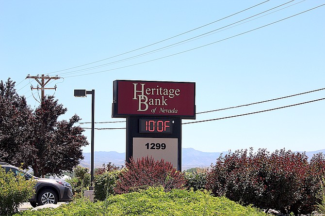
The Heritage Bank sign in Gardnerville registered 100 degrees at 2 p.m. Friday. While that sign tends to exaggerate a bit, It was definitely warm as a heat wave approaches Carson Valley.
Photo by Kurt Hildebrand.
No high temperature records fell on Saturday, with Minden-Tahoe Airport reporting 100 degrees and the gauge in Minden, proper, registering 96 degrees, well short of the 103-degree record set in the heat wave of 2005.
Most temperature readings topped out at around 100 degrees on Saturday, though Fredericksburg resident Jeff Garvin reported a scorching 107 degrees, a degree lower than Reno-Tahoe Airport’s new record of 106 degrees for the day. South Lake Tahoe also set a new record with 92 degrees, according to the National Weather Service in Reno.
An excessive heat warning remains in effect until 8 p.m. Monday, though today’s forecast high temperature has dropped a degree to 102 and Monday’s is down to 97 degrees.
“While temperatures will ease back on Monday, they are still likely to surpass 100 degrees across many Western Nevada valleys, with mid-upper 80s for the Tahoe and eastern Sierra communities,” Reno Meteorologist Mark Deutschendorf said on Sunday morning.
Hot temperatures are expected to linger through the week, and even warm back up into the upper 90s next weekend.
“Cooler overnight lows mainly in the upper 50s and 60s should keep Western Nevada valleys just below heat advisory thresholds, but we'll be keeping watch on the evolution of this ridge, which could lead to heat-related headlines again later in the week,” Deutschendorf said.
One unwelcome addition to the forecast is the possibility of thunderstorms today and Monday. With increasingly dry conditions, lightning strikes could start fires.
Previous Story
It is forecast to be 61 degrees out in Markleeville for the start of the Death Ride on Saturday and the temperatures will be climbing, along with the cyclists from there.
By 3 p.m. temperatures in the Alpine County seat are forecast to hit 99 degrees as death riders make their way back to the starting gate.
Highways throughout Alpine County sees hundreds of bicyclists for the Tour of the California Alps.
According to Alpine County, Highway 89 will be closed 5-7 a.m. from Turtle Rock Park to Markleeville, from 7 a.m. to noon from Monitor Pass to Hangman’s Bridge. Highway 4 will be closed from 5 a.m. to 4 p.m. from the junction with 89 to Lake Alpine.
“We kindly request the cooperation of all residents and commuters during these temporary road closures,” Alpine Spokesman J.T. Chavallier said. “We ask for your patience and understanding while the cyclists make their way back between 1-6 p.m. It is crucial for everyone to adhere to traffic regulations during this time.”
Things won’t be much cooler for the rest of the Sierra Front with an excessive heat warning in the valleys and a heat advisory in the mountains.
“Record-breaking to near record-breaking will be the name of the game through the weekend with many locations across Western Nevada well over 100-105 degrees,” National Weather Service Reno Meteorologist Edan Weishahn said on Friday. “While mountain communities will be cooler than the lower valleys, temperatures will still be well above typical for this time of year with low to mid 90s for many Sierra communities.”
As demonstrated by the low in Markleeville on Saturday, overnight temperatures won’t drop much below 70 degrees for most the region.
Weishahn cautioned residents to avoid outdoor activities during the peak heat of the day.
“If you can't reschedule, then be sure to stay hydrated and take plenty of breaks,” she said.
Both Saturday and Sunday are forecast to come within a degree of the record for Minden, according to National Weather Service records. Saturday is forecast to hit 102 degrees, with the temperature climbing to 103 degrees on Sunday.
“Thankfully the above normal temperatures won't stick around very long with more typical July highs and lows projected by Tuesday into the rest of the week,” Weishahn said.
The high temperature on Monday is supposed to drop to 98 degrees, with a chance of thunderstorms after 11 a.m.
That will raise the specter of potential lighting-caused fires.
“High pressure over the West followed by an incoming shortwave trough is a classic fire weather pattern for the Sierra and Western Nevada that provides a host of concerns,” Weishahn said. “First the hot, very dry conditions exacerbate the fuel dryness across the region. Any cloud to ground lightning may result in new ignitions. Thankfully this doesn't appear to be a widespread lightning potential, but definitely something to keep an eye on Sunday afternoon into Monday morning.”

Comments
Use the comment form below to begin a discussion about this content.
Sign in to comment