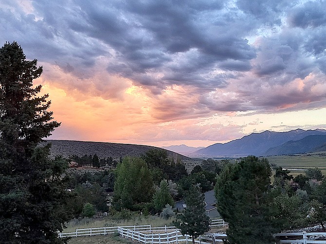
Clouds roll into Carson Valley on Friday night. Photo special to The R-C by Ellie Waller
A flood watch starting noon today has expanded into the Minden-Reno corridor.
The National Weather Service in Reno is alerting residents that flooding may occur in urban and areas of poor drainage.
“Hurricane Hilary will bring widespread impacts to much of the Southwest through Tuesday,” according to the watch. “The biggest concern remains flooding from excessive rainfall. While periods of rainfall are possible at anytime over the next four days, this afternoon through Monday will be the window where we will have the greatest flooding threat as the remnants of Hilary moves through central Nevada.”
Hilary is forecast to make landfall today in northern Baja and will rapidly weaken by the time it arrives in Nevada, there’s a lot of moisture associated with the system, forecasters said on Sunday morning.
“The greatest threat for flooding is across the Basin & Range and the eastern Sierra,” forecasters said. “However isolated flooding cannot be ruled out elsewhere across Western Nevada and Northeast California.”
Cloud cover should keep today’s high temperatures 10-20 degrees below normal today through Tuesday.
So far, Minden has seen .3 inches of the possible inch forecast to fall this weekend. Genoa has received .3 inches over Friday and Saturday. Lake Tahoe appeared to get the highest rain totals on Saturday, with Skyland at Lake Tahoe receiving .46 inches.
Dozens of lightning strikes hammered the Sierra near Blue Lakes on Saturday, setting the small Sawmill fire above Charity Valley. The fire was contained by 7:54 p.m., according to nevadafireinfo.org
Previous Story
Douglas County announced sandbag locations on Friday afternoon just two hours before a flash flood warning was issued for the Tamarack burn scar.
With .62 inches of rain falling above Holbrook Highlands from a thunderstorm and another half inch in the mountains due west of Topaz Lake, it’s likely that the wet weather being driven north by Hurricane Hillary will continue through the weekend.
Residents can find sand and bags at the Topaz Ranch Estates Community Center on Carter Drive and the Johnson Lane Fire Station on Stephanie Way. Residents need to bring a shovel.
Fredericksburg resident Jeff Garvin said his detector recorded 117 lightning strikes with .35 inches of rain.
“The lightning was amazing,” he said on Saturday morning.
At least one 100-square-foot spot fire was sparked along Leviathan Mine Road in the lightning storm. The fire was quickly extinguished by East Fork firefighters.
A surge of tropical moisture is forecast to arrive late tonight as most of the thunderstorms start to diminish.
“The sheer enormity of this system contributes to a very complex set of impacts across the region,” National Weather Service Reno Meteorologist Amanda Young said on Saturday. “As the core remnants for Hilary forces northward from Southern California into the eastern Sierra, (the) axis will shift westward into west-central Nevada Sunday.”
Young said the heaviest rainfall will begin Sunday across Mono and Mineral counties extending north to Highway 50 across the deserts.
There will also be a substantial cooling with the arrival of the storm.
“Daytime highs across the region during the period of greatest surge of deep tropical moisture will be 10-20 degrees below seasonal normal,” Young said.
Overnight cloudiness should keep low temperatures around average.

Comments
Use the comment form below to begin a discussion about this content.
Sign in to comment