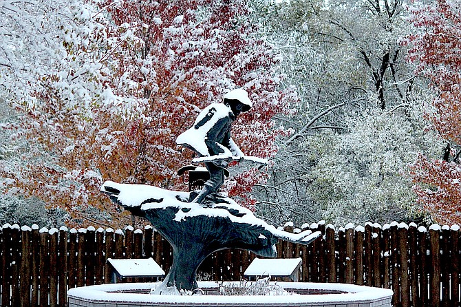
The statue of Snowshoe Thompson in Mormon Station State Historic Park in Genoa has a little snow on it Thursday morning. There could be more coming early next week.
Photo by Kurt Hildebrand.
A storm that could bring significant moisture to Western Nevada is waiting in the wings for early next week.
Forecasters are expressing increasing confidence that a low could drop down into Northern California bringing with it abundant moisture, according to Reno Forecaster Mark Deutschendorf.
“This setup would suggest a more widespread and potentially intense snow even for the Sierra and into Western Nevada compared to this week’s system, and windy conditions ahead of the main cold front,” he said. “Get ready for what could be an early season boost to the winter snowpack, but also prolonged travel hazards that come with storms of this magnitude,” he said.
Four inches of snow fell in Genoa early Thursday morning as cold air lifted a plume of moisture from Lake Tahoe to create a transfer of water to Carson Valley.
Areas north and south of the plume saw decreasing snow totals as it crosses Carson Valley.
Jacks Valley Road was warm enough to melt off the snow in the tire tracks so that it didn’t pose much of an issue to commuters on Thursday morning.
R-C weather watcher Stan Kapler said he had nearly 2 inches of snow on the measurement board in Minden which melted down to .17 inches. He said he’s received a quarter inch of precipitation so far this month for a total of .32 inches since the water year started on Oct. 1.
Gardnerville received about an inch of snow. Minden-Tahoe Airport’s automated weather system indicated light snow started falling just after midnight on Thursday. At one point visibility dropped down to a quarter-mile around 1 a.m. The airport reported .12 inches of moisture.
Fredericksburg resident Jeff Garvin reported just over an inch of snow in southern Carson Valley.
Snow telemetry at Heavenly Valley recorded nine inches of snow since Tuesday morning, with 3 inches falling since Wednesday morning.
Caples Lake reported 2.52 inches of precipitation in the last 24 hours with a snow depth of 6.6 inches.
A winter weather advisory will expire at 10 a.m. as the clouds begin to lift.
Cold dry weather is expected to arrive later today with another chance of showers and a stronger storm arriving Sunday night and into early next week.
Expect freezing temperatures on Friday morning if the cloud cover moves on with lows dropping into the teens before warming back up as the next front arrives.
A new storm is forecast to arrive in Western Nevada by late Saturday afternoon and evening including some moisture.
“Decent warming will precede this system will precede this system with highs south of Highway 50 pushing well into the 60s and snow levels look quite high. Winds will pick up 3-40 mph in lower elevations and up to 70 mph over the ridges.
But that storm might clear the path for a colder storm due in Sunday night and lasting through Election Day.

Comments
Use the comment form below to begin a discussion about this content.
Sign in to comment