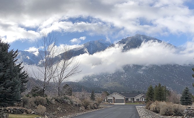
Jobs Peak picked up a little snow on Tuesday and is likely to see some more on Thursday. Jeff Garvin photo special to The R-C
Commuters should anticipate road controls above 5,000 feet Thursday morning, which includes any trips into the mountains, according to a winter weather advisory.
As of Wednesday morning, forecasters are predicting the best chances of snow accumulation will be above 6,000 feet where a transition to rain should begin starting later this morning in Carson Valley as the cold front arrives south of Highway 50.
As the front passes, temperatures are expected to drop. Cold winds on Thursday evening over Lake Tahoe could bring lake effect snows to far southern Carson Valley and Alpine County.
“The current timing suggests a messy Thursday morning commute for the urban areas with reduced visibility and wet roads at a minimum, with increasing chance for snow or slush for travel routes that go up in elevation,” National Weather Service Meteorologist Mark Deutschendorf said on Wednesday morning.
Precipitation in Minden will be fairly light, with around a quarter inch of rain forecast and the possibility of an inch of snow on the ground by Thursday morning.
The California Department of Transportation closed Monitor, Ebbetts, Sonora and Tioga passes on Monday in anticipation of the storm.
Temperatures are forecast to be much cooler on the other side of the front with the low in Minden expected to be in the mid-teens tonight. Carson Valley has seen slightly colder lows already this fall. The high temperature on Friday is forecast to hit 40 degrees under sunny skies.
Forecasters say the chance for some real winter weather will improve next week.
“Confidence is increasing in seeing significant weather impacts in the Sierra as a deep, cold and slow-moving longwave trough forms off the West Coast,” Reno Weather Service Meteorologist Tony Fuentes said.
Forecasters are still iffy on the timing of the storm, but it appears that whatever storm is in the cards will turn up early next week.
“It is increasingly likely we could see several days of significant and prolonged impacts across the Sierra as early as Sunday and extending even into next Wednesday,” Fuentes said.
Minden saw .19 inches of rain on Tuesday morning, while southern Carson Valley resident Jeff Garvin reported .26 inches.

Comments
Use the comment form below to begin a discussion about this content.
Sign in to comment