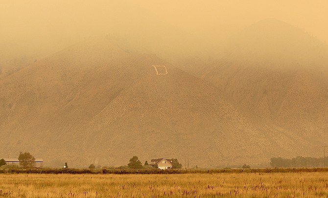
Smoke builds up in Carson Valley from the Caldor Fire on Sunday.
Evacuations ahead of the Caldor Fire have expanded to include Christmas Valley and other points south and east of Echo Summit.
The fire grew as much as 20,000 acres today burning to within two miles of Echo Summit and a mile of Highway 88 near the Mormon Emigrant Trail junction.
Fire mapping indicates potential hot spots marching due west toward Highway 89 near Meyers and Silver Lake along Highway 89 in Alpine County.
The closure of Highway 50 has moved east to Sawmill Road. Also closed are Pioneer Trail at Elks Club, Elks Club at Highway 50 and Pickett's Junction in Hope Valley.
According to the El Dorado County Sheriff’s Office the evacuations have expanded as follows:
El Dorado County
• Christmas Valley from Highway 89 west to Echo Summit
• Highway 89 due west to Watershed Ridge/Echo Summit and south to the Amador/El Dorado County line.
• The area from Luther Pass Road, north along the El Dorado/Alpine County line to Armstrong Pass. West from Armstrong Pass to Upper Apache at Meyers. West on Upper Apache to Highway 50. West on Highway 50 to Highway 89. South on Highway 89 to the El Dorado/Alpine County line. This includes all homes on both sides of Highway 89.
• The area from Upper Apache at Meyers, north along Highway 50, to Elks Club Drive. East on Elks Club Drive to Pioneer Trail, extending due south to Upper Apache at Meyers. (This includes all homes off of Oneidas, Mandan, Apache, Ottawa and Player).
• The area North on Highway 50 from Highway 89 to Saw Mill Road. West on Saw Mill Road to Angora Ridge, extending to the Echo Summit.
Alpine County
• Highway 89 South from Luther Pass Road to Pickets Junction (Highway 88)
• West on Highway 88 to Kirkwood
Evacuation Routes:
El Dorado County
• Residents evacuating the area should use Highway 50 east or Highway 89 north.
Alpine County
• West on Highway 88 to Northbound 89 to Eastbound Highway 50
Evacuation Warning:
El Dorado County
• The area from Sawmill Road at Lake Tahoe Blvd. extending north to Pope Beach. Along the water’s edge to Eagle Point. From Eagle Point west, to Desolation Wilderness, across Emerald Bay.
Road Closures:
• The Highway 50 closure has been extended East to Sawmill Road
• Highway 50 at Sawmill
• Pioneer Trail at Elks Club
• Elks Club at Highway 50
• Highway 89 at Highway 88 junction
• Fallen Leaf at Tahoe Mountain
Evacuation Shelter: Nevada
• A Red Cross Shelter is open for those evacuating from the area at the Douglas County Community Center, 1329 Waterloo Lane, Gardnerville, NV.

Comments
Use the comment form below to begin a discussion about this content.
Sign in to comment