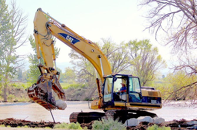
An excavator is moving boulders onto the banks of the East Fork upstream from the Highway 88 bridge on Friday morning.
Photo by Kurt Hildebrand.
Even though Monitor Pass is now open, there is more water locked up in the snowpack in that location then there has ever been, according to Natural Resources Conservation Service snow telemetry.
Monitor sits at the cusp of the Carson and Walker river basins, and they are both seeing increased river flow as a result of snowmelt in the mountains.
According to telemetry, there was 31.4 inches of snow-water equivalent at the site on Friday, more than 10 inches above the record at the site set May 19, 1995. That’s nearly triple of its 30-year record.
It peaked on April 9 at 56.6 inches, 20 inches more than its peak of 36.3 inches on April 19, 2017.
Southwest of Monitor, at Ebbetts Pass, there was still 69.3 inches of water locked in the snowpack at the top of the East Fork of the Carson River.
Snow telemetry shows that curve is finally dropping as warm temperatures begin to dent the record snowpack.
According to figures, Ebbetts peaked at 77.6 inches on May 10, higher than the 1995 record for the date.
Warm temperatures have increase melt-off. While Carson Valley residents are sweltering under temperatures rising into the upper 80s, it’s cracking 61 degrees at Ebbetts Pass, with lows remaining well above the freezing mark.
A flood watch remains in effect for much of Western Nevada, including the Carson and Walker rivers. The watch is expected to expire on Monday night.
In response, the county has updated its list of sandbag locations, which are free and open to the public. The county’s incident page is being actively updated as new information about conditions arises.
The East Fork of the Carson River is anticipated to crest at 14.3 feet 6 a.m. Monday, according to a forecast issued on Friday morning.
The river will crack the 14-foot minor flood stage 14.2 feet 5 a.m. Sunday.
So far, the river’s peak was 13.29 feet 3:10 a.m. Thursday. To put that in perspective, the river crested at 16.13 feet on Jan. 9, 2017.
The possibility of showers or thunderstorms might actually slow the melt-off, according to forecasters.
“Although waterway rises will follow a daily melt cycle with peaks overnight and early morning in many places, the heightened shower and thunderstorm potential will bring increased cloud cover and a slight dampening of the daily melt cycle,” forecasters said.
High temperatures are expected to climb to near 86-87 degrees this weekend.

Comments
Use the comment form below to begin a discussion about this content.
Sign in to comment