Highway 50 at Lake Tahoe is the subject of a survey.
An online survey has been released by the Nevada Department of Transportation to provide feedback about proposed future improvements to Highway 50 on Tahoe’s east shore, including potential temporary test restriping of a section of highway lanes.
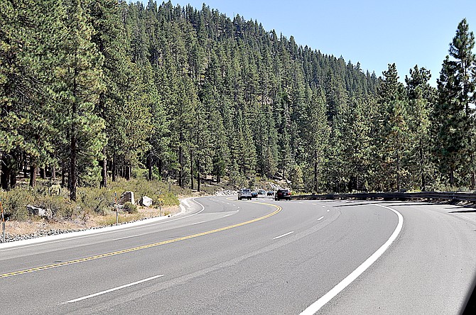
Members of the public can visit dot.nv.gov/US50EastShore by Sept. 30 to provide feedback on the corridor, including input on a proposed demonstration project to reconfigure an approximate one-mile section of highway lanes.
Residents along the corridor have been opposed to any efforts to reconfigure the route which travels along the east shore of Lake Tahoe. According to the state, there are no plans to actually alter the width of the roadway, just restripe it.
“While there are no proposals to reduce the overall footprint of existing U.S. 50, there are some concepts which could include new physical infrastructure on small sections of the highway,” State Transportation Spokeswoman Meg Ragonese said. “As part of pre-existing regional plans, NDOT’s U.S. 50 East Shore Corridor Study does incorporate the Tahoe Trail. The path is envisioned to be a separated path located on USFS/NDSP land where possible. If there are areas where the path runs alongside U.S. 50, it would be separated by a barrier.”
Another proposal would be to convert the intersection of Highway 50 and 28 into a roundabout in an effort to reduce crashes there.
A motorist who pulled out in front of a bus earlier this summer became the second fatality in Douglas County this year.
The proposed temporary striping would reconfigure a nearly one-mile section of the highway from two lanes to one lane in each direction, with a middle turn lane, from south of Zephyr Cove Resort to Round Hill Pines Beach Resort. The test reconfiguration would include a two-way middle turn lane for safer, designated turns and smoother, more reliable traffic flow.
The proposed lane reconfigurations are aimed at providing safer travel by bringing average driving speeds closer to the posted speed limit. Temporary striping would be required to be removed after the trial period. The test would allow NDOT to gather traffic speed and safety data, as well as public feedback, to inform any potential future highway lane reconfigurations as part of the U.S. 50 Tahoe East Shore Corridor Management Plan.
On average, more 100 crashes occur every year on the corridor, almost 1/3 of which are documented to have speed as a contributing factor. The Federal Highway Administration (FHWA) reports that typical roadway reconfigurations can reduce crashes between 19 and 47 percent and lead to more consistent travel speeds.
The survey is part of a continuing process to gather stakeholder and public feedback to finalize the U.S. 50 Tahoe East Shore Corridor Management Plan. The plan proposes a range of future vehicle, transit and multi-modal strategies to enhance roadway safety and mobility on U.S. 50 between Spooner Summit and the Nevada-California border. The study is being conducted in coordination with other local, state and federal agencies. To date, outreach efforts have included engaging with nearly 400 public outreach tour attendees and reviewing 1,530 public and stakeholder comments. Study information is available at dot.nv.gov/US50EastShore.
Additional state highway information is available at dot.nv.gov or by calling (775) 888-7000. Also follow @NevadaDOTReno on Twitter for traffic and project updates in northern Nevada, and @nevadadot on Twitter, Facebook, and Instagram for updates from across the state.

Comments
Use the comment form below to begin a discussion about this content.
Sign in to comment