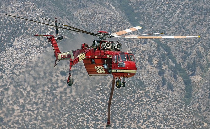
A firefighting helicopter flies in Alpine County to help hand crews put out the East Fork Fire. JT Humphrey Photo
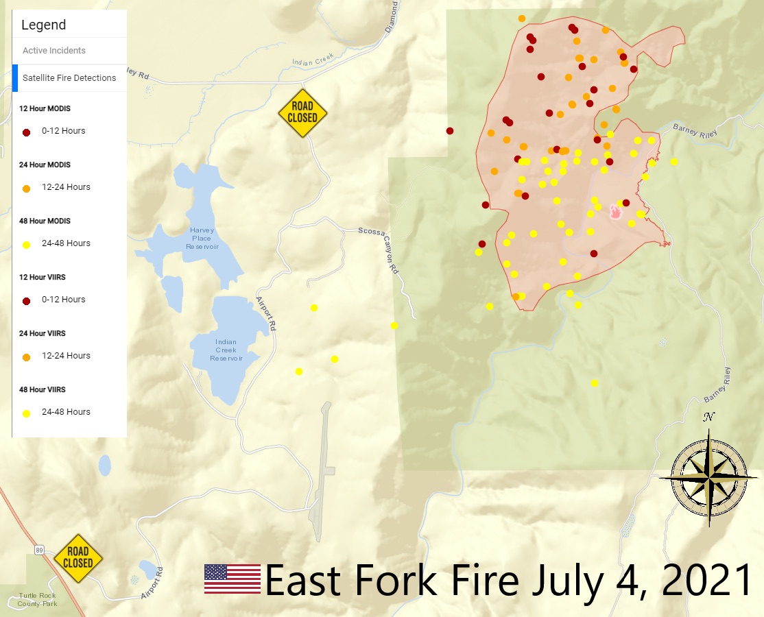
The East Fork Fire added 100 acres to its size on Independence Day, but firefighters managed to cut a line 30 percent around the 1,100-acre fire.
As of the afternoon of July 4, all established containment lines are holding.
"There is smoke and fire activity on the western edge of the fire, where brush and trees within containment lines are burning," fire officials said. "Crews are working the active southeastern edge of the fire with aerial support and bucket drops."
Ten hand crews are working on the fire, with the aid of five large air tankers, seven helicopters and four engines.
Enough rain fell on the 1,000-acre East Fork Fire to slow it down over night, giving firefighters a shot at lassoing the fire that has been burning since Thursday.
“The fire received a good amount of rain last night,” officials said. “Firefighters are taking advantage of the favorable humid conditions. There is a large spot fire outside the main containment lines where they are focusing their efforts.”
The plan is to use aircraft to col down the fire’s educes and strengthen its lines in the rugged terrain on both sides of the Carson River.
Previous Story:
Firefighters managed to make some progress toward getting a line around the East Fork Fire burning southeast of Gardnerville
At last report, firefighters reached 15 percent containment of the fire burning in the drainage of the East Fork of the Carson River near Cottonwood Canyon. The Nevada Wildfire Information map indicated the fire was at 1,102 acres on Sunday morning, up from 750 acres reported last night after a strong wind gust from a storm cell fanned the flames on Saturday afternoon.
A storm cell passed through Western Nevada north of the fire at around 4 a.m., with a score of lightning strikes detected in Smith Valley.
There was a brief gust of wind out of the northeast at around dawn, but then things died down. A red flag warning for potential dry lightning and gusty winds expires at 11 a.m. today.
Concerns about a possible run prompted fire officials to contact both the Woodfords Colony of the Washoe Tribe to the west and China Spring Youth Camp to the northeast. Fire and retardant lines held on the west side of the fire through the evening, but it grew toward China Spring.
There was no report the camp was evacuated overnight.
Air quality improved slightly overnight with the Gardnerville Ranchos gauge going from unhealthy for sensitive groups at midnight to good by 2 a.m.
Isolated showers and then scattered showers and thunderstorms are forecast for Minden after 9 a.m. today. Widespread haze is expected between 9 a.m. and noon. Otherwise, the forecast is for mostly sunny skies with a high near 92 degrees, with the wind out of the west at 10-15 mph in the afternoon, gusting to 25 mph.
There should be a break from thunderstorms for a few days next week, but they’ll be back on Thursday and Friday.
Hot temperatures are also expected to return by Tuesday, with highs hitting 98 and then climbing to 101 degrees by Saturday.

Comments
Use the comment form below to begin a discussion about this content.
Sign in to comment