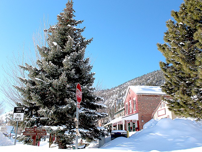
Downtown Genoa greets the sun on Monday morning after a stormy weekend. Nevada's oldest town saw almost a half-foot of snow from the last storm.
Photo by Kurt Hildebrand.
Heavenly was able to open the lower California and Nevada lifts 90 minutes early on Monday, though the Gondola will be closed for the day.
Blizzard conditions closed the resort on Sunday with 20 inches of new powder reported between Sunday and Monday.
Minden weather watcher Stan Kapler reported receiving 5 inches of snow over the two-day storm.
Kapler has recorded more than 6 feet of snow in the Douglas County seat since the water year started on Oct. 1, bringing the total precipitation for the water year up to 15.3 inches. The record for annual precipitation in Minden was set in 2017 when 20 inches fell during the calendar year.
There may be occasional light snow through Wednesday, mostly in the Sierra.
“Between today and Wednesday, expect up to 2 feet of new snow
accumulation on the Sierra crest generally north of US-50, 4-8
inches in the Tahoe Basin, 2-6 inches in northeast California, and
up to 2 inches of more spotty accumulations for Mono County and
Western Nevada,” Weather Service Meteorologist Brittany Whitlam said on Monday. “While these aren't overly impressive snow totals for the Sierra, plan on periods of travel delays and disruptions through Wednesday.”
A warmer storm is expected to arrive in the central Sierra on Friday morning with lower snow levels that are expected to rise through the day.
As of Monday, there isn’t a solid answer on where snow levels will be with the end of week storm, according to Whitlam.
A relatively low snow level could preserve the snow that’s already fallen in lower elevations, while a high elevation could see more snow melting off the mountains and into the Valley.
“Confidence on just how these snow levels will rise, however, remain low as there is wide variation in even the probabilistic side of things,” she said. “It’s important not to zero in on specific details at this point.”
Previous Story
An avalanche warning has been issued Sunday through Monday as new snow falls across the Sierra Front.
The Sierra Avalanche Center in Truckee issued the backcountry warning for the Sierra between Ebbetts Pass north to Yuba Pass including all of Lake Tahoe.
“A winter storm with gale-force winds and high intensity snowfall will cause widespread avalanche activity in the mountains,” according to the warning. “Large avalanches could occur in a variety of areas and elevations.”
A winter storm warning remains in effect for the Lake Tahoe area through 4 a.m. Monday.
Extreme weather and road closures prompted Heavenly Ski Resort to close for the day on Sunday.
A second burst of snow arrived in Carson Valley around 3:30 a.m. Sunday, according to the Minden-Tahoe Airport automated weather system.
While winds didn’t gust more than 29 mph at the airport, it was sufficient to send the cold, light snow flying, reducing visibility to under a quarter mile at times.
Fredericksburg resident Jeff Garvin reported 3 inches of new snow with some drifts up to a yard deep. A location a mile north of Genoa recorded 5 inches of fresh powder.
As of 8:25 a.m., the Nevada Highway Patrol was reporting a noninjury collision on Interstate 580 at Fairview, and was assisting motorists at Spooner Junction, Highway 50 and Golf Club Drive, on Interstate 580 at Bowers Mansion and at Highway 50 and Glenbrook, over the previous hour.
It has just been a week since a 36-car pile-up closed Interstate 580 on Feb. 26 due to blowing snow, low visibility and slick conditions.
Since then, Nevada Highway Patrol Northern Command troopers have responded to 1,895 calls for service, assisted 464 motorists, and responded to 97 slide-off incidents, according to figures released on Saturday.
Troopers also responded to 132 injury crashes and are investigating 24 hit-and-runs and 193 property crashes. Most of the crash-causing violations were from traveling too fast with the snow and ice conditions and slide-offs due to vehicles not being prepared for the weather.
• Remove snow and ice from all vehicle windows, mirrors, lights, turn signals and license
plates.
• Buckle up.
• Turn on headlights to see and be seen.
• Do not rely solely on GPS to find alternate routes, as it could lead to unmaintained roadways
or hazardous areas.
• Slow down! Reduce speed. Speed limits are based on normal road and weather conditions,
not winter road conditions.
• Avoid quick starts, stops and fast turns. Accelerate, brake and steer smoothly and gradually.
• Do not brake suddenly.
• Keep additional distance from other vehicles.
• Watch carefully for snow removal equipment, first responders, tow trucks and stranded
motorists and vehicles – move over and do not pass without good distance and sight
clearance.
• Use extra caution on bridges, ramps, overpasses, and shaded areas.
• Be aware of black ice.
Check before you go:
Tires, Brakes, Lights, Battery, Wipers, Defroster, Heater, Vehicle Fluid Levels.
Carry with you:
Tire chains, Flashlight, Ice scraper, Snow shovel, First-aid supplies, Extra clothes/gloves, Blanket,
Flares, Non-perishable food/water.

Comments
Use the comment form below to begin a discussion about this content.
Sign in to comment