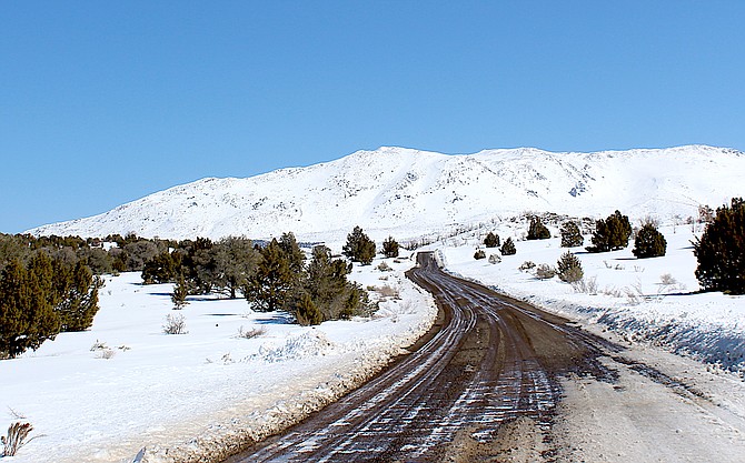
The Pine Nuts are a study in white and blue on Friday morning.
Photo by Kurt Hildebrand.
There are around 30 snow telemetry sites in the Sierra between Stampede Reservoir and Mono Lake monitoring the Carson, Walker and Truckee river basins.
The term SnoTel first appeared in The Record-Courier on Feb. 16, 1978, in a feature written by Joyce Hollister describing how Nevada had been checking the snowpack since 1906, which is coincidentally when weather records began being kept in Minden.
By 1981, there were 475 of the sensors in the mountains across the West, radioing in reports from some of the most remote locations in the United States.
But while there are dozens of telemetry sites in the Sierra, there isn’t one located in the Pine Nut Mountains, so people determine the snowpack there, the way they have for thousands of years — by looking at them.
“A week and a half ago, I flew to Arizona over the north end of the Pine Nuts, and said to myself ‘that looks really white,’” National Weather Service Meteorologist Chris Smallcomb told the Local Emergency Planning Committee on Wednesday.
The Weather Service can estimate the snowpack from satellite data, but there is no on-the-ground measurement, like snow telemetry.
East Fork Fire Chief Tod Carlini raised the issue, pointing out that some longtime residents are saying it’s the most snow they’ve ever seen in the mountain range east of Carson Valley.
At almost 9,444 feet in elevation, Mount Siegel is one of the tallest mountains in Douglas County. East Peak in the Carson Range is less than 150 feet taller at 9,591 feet.
But despite their height and breadth, the Pine Nuts are not regular moisture producers, hence the lack of monitoring equipment.
There is a post fire weather station just east of Mount Siegel that indicates 26.7 inches of snow as of 9 a.m. Thursday representing 14.24 inches of accumulated precipitation.
“They are definitely above normal,” Smallcomb said. “The thing is the low elevation. Snow across the 6,000 foot level is unusually high. It will be a factor going into melt season.”
Carlini said the fire district will be conducting a spring runoff session inviting the agricultural community and water masters in addition to emergency managers.
He said the district is anticipating the real possibility of flooding this year.
Smallcomb said the question of when and where flooding will occur this spring depends on what warm storms arrive in Western Nevada.
He said snowpack in the Carson River basin is more than double the median peak, which it usually doesn’t reach until later this month or even early in April.
Irrigation season arrives April 1, and Smallcomb said streamflow could hit 200-250 percent of average.
He said it will depend on how warm April May and June are.
“When you have snowpack this deep, you have to keep flooding on your radar,” he said. “The Carson River Basin doesn’t have a lot of upstream capacity to store water, so what’s up there will come down at some point. It just depends on the weather.
He played down concerns about potential warm atmospheric rivers arriving in Western Nevada that might melt snow in higher elevations.
“Fortunately, we’re not seeing super warm atmospheric rivers at this point, or any super warm-ups,” he said.
A winter storm watch takes effect Saturday morning in the greater Lake Tahoe area with a chance of 1-2 feet of snow at Lake level and 2-3 feet above 7,000 feet.
National Weather Service Reno Meteorologist Amanda Young said to anticipate the storm arriving in Carson Valley by Saturday evening, with light to moderate snow.
“By the weekend, the March lion will once again be on the prowl,” she said. “His growl will be heard first across higher Sierra ridgetops as gusty winds reach 100-plus mph with winds gusting to 40-50 mph mixing down to Western Nevada valleys later Saturday morning and afternoon.”

Comments
Use the comment form below to begin a discussion about this content.
Sign in to comment