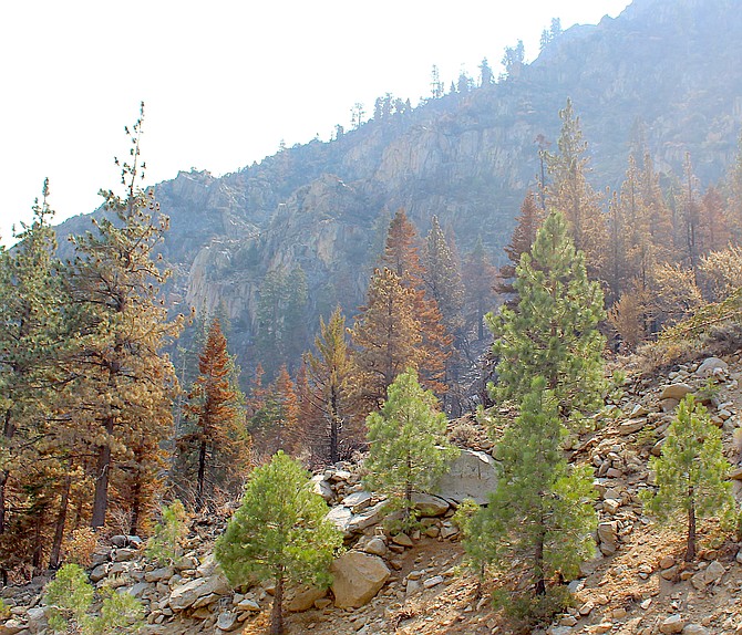
Burned areas above Highway 88 in November.
Visitors to the Humboldt-Toiyabe National Forest’s Carson Ranger District are being reminded to stay out of closed campgrounds and follow warning signs when recreating in the area burned by the 2021 Tamarack Fire near Markleeville.
Burned landscapes present numerous safety hazards for recreationists that either did not exist prior to the fire or have been exacerbated by the effects of the fire.
“While full recovery of the landscape burnt in the Tamarack Fire will take time," said Carson Ranger District Recreation Officer Brian Hansen. “Visitors to this area may already see meadows bouncing back, shrubs resprouting, and tree seedlings reestablishing.”
There is no area closure in place, so all trailheads and trails in the Tamarack burned area are now accessible, including Charity Valley East, Burnside Lake, and Thornburg Canyon. Hikers should be prepared to navigate without trails or trail signs, so make sure to bring along a map and GPS app or device. Also, it is important to stay on the trail as much as possible, because without live plant roots to anchor the soil, burned soil is easily erodible.
Crystal Springs Campground will remain closed due to concerns about the stability of the hillside that was blackened above the campground.
Also, due to the greater risk of flash floods the lower part of Markleeville Campground by the river will stay closed. Hope Valley, Kit Carson, Silver Creek, and the upper campsites of Markleeville Campgrounds, as well as Centerville Flat and Wolf Creek Dispersed Campgrounds, will be open as weather and conditions allow.
For more information visit: https://bit.ly/CarsonRDRecreationInfo or call the Carson Ranger District at 775-882-2766.
For people recreating in areas that were affect by a fire, please keep the follow in mind:
Flash Floods/Debris Flows: Fast-moving, highly destructive flash floods and debris flows triggered by intense rainfall are one of the most dangerous post-fire hazards. The risk of floods and debris flows after fires increases due to vegetation loss and soil exposure. Always avoid recreating in a post-fire area during a rain event. If caught unaware, get to high ground. Never attempt to drive or hike through an area that has been flooded or if a debris flow has occurred. These types of events hide dips in roads or trails and other obstacles. Worse still, there may not be a road or trail at all. Flooding and debris flows can wash away the entire road or trail surface and a significant amount of ground beneath
Damaged or Dead Trees: After a fire many trees are weakened from burning around the base of the trunk. These trees can fall over or blow down without warning. Shallow-rooted trees can also fall. Therefore, be extremely alert when around burned trees, especially after rain events or during high winds. Never picnic, camp, or park a vehicle close to dead trees. Look up while on trails and if the wind really kicks up, head to a clearing out of reach of any potential falling trees.
Burned Stump Holes/Root Chambers: Burned stumps may create rather obvious large holes, but these holes may actually be bigger. In many cases, the fire may have traveled through the root chambers and consumed the woody root material leaving vacant chambers where solid wood used to be. Overtime, these root chambers will collapse. A person’s body or vehicle weight on the root chambers may cause them to collapse, potentially opening a hole. Large trees have particularly large root chambers that can also be very deep. Be especially wary after rain as the moisture may travel through the root chambers and make collapse easier.

Comments
Use the comment form below to begin a discussion about this content.
Sign in to comment