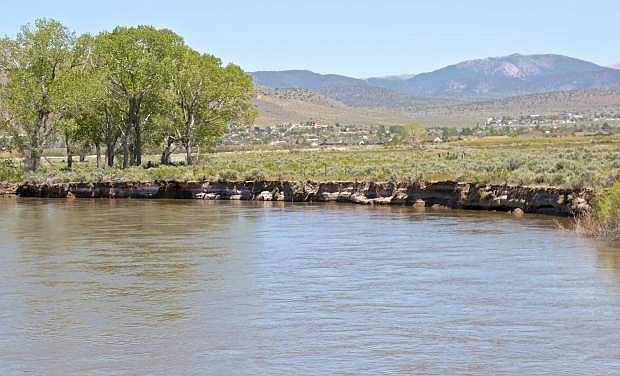
The Carson River is flowing fast and high as seen here Friday from the Cradlebaugh Bridge in Minden.
Rising temperatures will be above average for this time of year and the region can expect the first period of melting snowpack to begin next week that will possibly rival the record from 1997, said the National Weather Service in Reno.
Next week is when locals should worry and take action, said NWS, as temperatures will rise 15 degrees above normal. Normally during this month, the high is around 74 degrees.
What’s even more eye-opening is the amount of water certain areas are holding. According to Mount Rose’s ski sensor, there’s 79 inches of water in the snowpack.
The NWS has issued a flood watch warning for Sunday through Tuesday in Carson City, Douglas and Washoe counties and the greater Lake Tahoe area — saying the area is about to deal with an exceptionally large snowmelt.
What Carson City should know
As for the Carson River, it’s holding 65 inches and it’s forecasted the area near Deer Run Road will reach 8.1 feet by Wednesday morning.
Anything above 8 feet is considered a time to prepare for possible flooding, which begins at 10 feet. This is overwhelming for mid-May and it’s warm enough where snowpack will no longer freeze overnight.
Sean Slamon, Carson City fire chief, said the city’s main concern remains flooding in other areas affecting access in and out of the capital.
He said that includes flooding over Highway 395 at Cradlebaugh Bridge in Carson Valley which would cut off Carson City to the south.
“As far as the city goes, we have employees who live out there and it is a transportation route,” said Slamon. “As for the city, we aren’t concerned. The creek flows are doing pretty good. Some creeks may get over their banks but we don’t see problems. The weather recently has been optimal with controlled melting.”
Robb Fellows, senior project manager, stormwater, Carson City Public Works, in April said problems could arise if either Ash Canyon or Kings Canyon creeks reached 50 or more cubic feet per second (cfs).
On Friday, the gauge at Ash Canyon Creek was recording 10 cfs while Kings Canyon Creek was just above 1 cfs.
All in all, Carson City will be witnessing an increase of flows with impacts, said NWS. But the Walker River is the most susceptible to flooding, especially in Mason Valley near Yerington and could compare to flooding in 2011, said NWS.
Lyon County braces for another overflow
The Walker Basin is the greatest concern, said NWS, as it’s holding 118 inches of snowpack water.
Lyon County Manager Jeff Page said the town of Yerington is coming together to help one another. The Rotary Club of Yerington, Yerington High School, and other youth leadership groups are assembling sandbags for seniors and residents whom are physically disabled. Farmers are rebuilding their existing levees on properties and are preparing to slow water flow in irrigation ditches.
On the city’s side, Page said it has been preparing infrastructure and utility plans for the week, and removed debris from drains.
“We’re anticipating to have water flooding the streets and not the buildings,” he said. “We’re heavily focusing on the areas near or around the river for sandbag fillings, especially if it’s experienced flooding in the past.”
But another concern for Page is the water is expected to flow at 3800 cfs.
“In 1997, it was gone within a few days,” he said.
Is it all coming at once or will it gradually evaporate? The NWS said this winter’s flooding hit quickly but this time, it’s going to last for a while.
The snowmelt and flow is similar to records dating back to 1997 and could potentially continue by middle to end of next week, they said.
Page also suggested locals south of Yerington secure their properties, such as propane tanks and outside decor, to prevent drain and river blockage.
By the end of next week, the flow running through Walker River and Mason Valley could increase three times than its current state, which is already at monitor stage.
What’s happening at the lake
South Lake Tahoe also will be experiencing temperatures above average for this time of year, said NWS.
By middle of next week, the forecast is mid 70s when usually it would be ranging in the 60s.
And with the amount of snow that’s sitting on the mountains, rising temperatures also will be prolonged in the area.
Through the first week of June, the area’s warmth will increase. The Truckee River’s snow water equivalent reached 332 percent above normal on Friday.
Carson City’s forecast will reach the 80s on Sunday, hitting highs of 85 on Tuesday and Wednesday. There’s also a slight chance of thunderstorms Tuesday through Thursday.
To follow data on river levels and observations, visit U.S. Geological Services water website, waterdata.usgs.gov.

Comments
Use the comment form below to begin a discussion about this content.
Sign in to comment