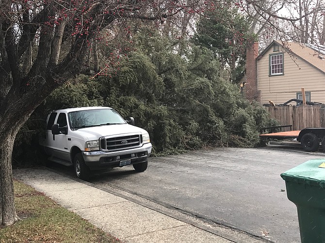
High winds, with gusts up to 80 miles per hour are possible today. Carson City said Wednesday that the city’s storm drain system is surcharged, and storm water is coming out of the drains onto the streets near the downtown. Please slow down and be cautious when driving on streets that have water over the roadway. The following roads remain closed: • Rhodes Street is closed from Carson Street to Curry Street, except to local business traffic. • A 100 foot section of Combs Canyon Road that’s 1/8 of a mile south of the Lakeview Road intersection — travel is reduced to one lane, please use caution and yield to oncoming traffic. Residents are advised to use the Highway 395 egress/ingress for the Lakeview subdivision. Carson City Public Works encourages residents to visit www.carson.org to stay up-to-date on the weather, road closures, trail/path closures, sandbag locations and resources that are deployed across the city. Additional public information that’s released will be posted to the City website flood page. A Flood Hotline has been designated for flood related reporting and questions, which are not life-threatening. The number is (775) 887-2355 and officials ask the public to use this number instead of 9-1-1 for non-emergency flood calls. Please be watchful of City crews working as they continue to mitigate and assess storm damage.
In Douglas County, the East Fork of the Carson River rose high enough to send water into the low lying areas of Aspen Mobile Home Park in Gardnerville, but not as high as it was in January. No one has been evacuated, according to last report, The Record-Courier reported.
However, the rise came to within 2 feet of flood stage on the East Fork and raises the concern about what will happen today and Friday should snow levels continue to rise.
Workers digging up the water line on Romans Road in Indian Hills found a 20-foot stick of 12-inch pipe that had split. They’ll be digging that up today, which means no water for Sierra Lutheran High School again. No word from the school on whether they’ll try to open.•••
For safety, the Nevada Department of Transportation has closed U.S. 50 in the Cave Rock area of Lake Tahoe following five large boulders falling onto the roadway.
During the past three days, boulders roughly the size of large passenger vehicles fell from a roadside slope onto eastbound travel lanes. For safety, travel lanes have been reduced to one lane in each direction since Tuesday, with both directions of traffic shifted to westbound lanes away from the rock fall area.
No vehicles were involved in the slides, and no injuries were reported. The rock fall occurred near Logan Creek Drive north of Cave Rock.
The likelihood of rockslides, mudslides and avalanches in mountainous areas continues to be high as Mother Nature drops more snow in the mountains and rain on the valley floors.
The National Weather Service said Wednesday afternoon, another strong atmospheric river storm will impact the region today through Saturday. Significant travel impacts are expected due to strong winds, heavy rain, additional flooding, and more high elevation mountain snow.
Most heavy snowfall will be above 8,000 feet with snow levels not reaching Lake Tahoe level until Friday afternoon. The snow is expected to reach the valley floors by Saturday morning. Snow totals are expected to be 1-2 feet above 8,000 feet with up to 3 feet along the Sierra crest. Winds were expected to be between 70 and 90 mph in wind-prone areas.
Minimal snow accumulations are expected in western Nevada.
The Carson River was nearing flood stage at 7.23 feet Wednesday. The river was expected to rise to 9.3 feet today and stay there until Saturday morning.
Most area creeks and streams are already at capacity and mainstem rivers in northeastern California are already at flood stage or forecast to reach moderate to major flood levels.
“After a very active winter conditions are ripe for widespread flooding impacts as the region can no longer sustain heavy rainfall,” said the National Weather Service.
Carson City staff expected periods of heavy rain beginning late Wednesday, early this morning. In addition to the rain, the city is expected to experience high winds, with gusts between 70-80 miles per hour.
The City’s storm drain system is surcharged, and storm water is coming out of the drains onto the streets near the downtown. Please slow down and be cautious when driving on streets that have water over the roadway.
Carson City Public Works encourages residents to visit www.carson.org to stay up-to-date on the weather, road closures, trail/path closures, sandbag locations and resources that are deployed across the city. Additional public information that’s released will be posted to the City website flood page.
A Flood Hotline has been designated for flood related reporting and questions, which are not life-threatening. The number is (775) 887-2355 and officials ask the public to use this number instead of 9-1-1 for non-emergency flood calls.
Please be watchful of City crews working as they continue to mitigate and assess storm damage.
January’s flood damage caused at least $1.67 million in damage to the city’s parks and recreation facilities, the Parks and Recreation Commission was told Tuesday.
The hardest hit were Riverview Park trails, which incurred about $612,000 in damages, Steve Brunner, deputy director, Parks, Recreation & Open Space, told the Parks and Recreation Commission Tuesday.
Other affected areas include Empire Ranch Estates Park, hit with $315,000 in damages; Riverview Trail, assessed at $186,000; and the Linear Ditch Trail with $150,000 in needed repairs.
Governors Field and Pete Livermore Sports Complex suffered $40,000 and $32,000 in damages, respectively.
“Our high priority is to make the fields at sports complexes safe for the kids who use them,” starting this month or next, said Jennifer Budge, director, Parks and Rec.
Budge said she expected further erosion and damage from this week’s floods.
She also cautioned hikers eager to get back on the trails to be careful.
“Really use caution on trails. Make sure you’re with someone, have a phone with you, and tell someone where you’re going,” Budge said.
As for Lyon County, officials urge the public to keep all flood mitigation efforts in place. Sandbag locations have been left open since the January event. Crews continue to monitor roads and drainages and will continue to report any problems. There have been no reported fatalities or injuries and no evacuations are in place.
Many roads in Dayton, Stagecoach and Silver Springs had substantial water flowing down them.
Lyon County urges citizens not to call 9-1-1 or dispatch unless they’re experiencing a life threatening emergency. Call 463-6531 and leave a message if your call can’t be answered or email your road damage to flood@lyon-county.org.
In Tahoe, NDOT said the large boulders near Cave Rock remain perched on the destabilized roadside slope, and the temporary road closure is a safety precaution. The road will be reopened once deemed safe.
To enhance traffic safety, NDOT has placed two rows of concrete barrier rail on the closed eastbound side of the roadway to help capture any additional boulders before sliding into traffic. A sloped berm of gravel will be placed behind the barrier rail to help further diffuse and prevent rock fall onto travel lanes.
With traffic safety a priority, NDOT dedicated approximately $15 million to enhancing traffic safety by stabilizing roadside slopes to reduce rockslide and other erosion in U.S. 50 at Tahoe. The majority of U.S. 50 roadside slopes in the Glenbrook area have already been stabilized with rock fall netting or reinforced roadside slopes or have barrier rail/wall built at the bottom to contain and collect erosion-related rock fall. Last year, NDOT also extended the westbound, lakeside Cave Rock tunnel entrance. The new approximately 60-foot long and 27-foot tall structure extends the previous tunnel.
to enhance safety by catching rock fall before it reaches the roadway.
SAN JOAQUIN VALLEY HIT HARD
Around the region, nearly 5 inches of rain fell in a 12-hour span in the San Joaquin Valley, swamping roads and swelling waterways to critical levels, according to The Associated Press
Authorities said an earthen dam on Lewis Forks south of Yosemite National Park was in imminent danger of failing, and downstream residents in the rural Cedar Valley area should be ready to evacuate.
To the north, officials shut down water flow from a dam in Butte County after chunks of concrete went flying off the spillway, creating a 200-foot-long, 30-foot-deep hole.
The Department of Water Resources said the erosion at Lake Oroville does not pose a threat to the earthen dam or public safety, and the reservoir has plenty of capacity to handle the continuing rain.
The weather service said the storms were part of a “classic pineapple express,” referring to an atmospheric river phenomenon that carries moisture across the Pacific Ocean from Hawaii and dumps it on Northern California. It could deliver even more rain starting today, forecasters predicted.
“If the model guidance is correct this next system could be even juicier moisture wise as it has a decent tropical connection,” according to a weather service statement.

Comments
Use the comment form below to begin a discussion about this content.
Sign in to comment