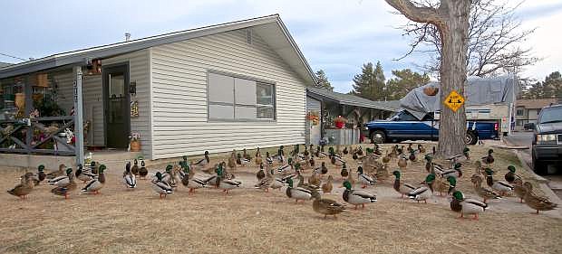
Dozens of ducks congregate on the lawn of a house on the corner of 10th and Division in downtown Carson City Friday evening.
Christmas will be barely white but frigid this year, thanks to snowfall Wednesday that could stick around through the weekend.
A cold front with high winds is moving into the area tonight and up to two inches of snow is expected to fall on valley floors Wednesday morning.
That should be the end of the precipitation, but it will be cold and the snow will likely linger.
“We’re expecting a reinforcing shot of cold air Saturday. The concern will be if there is snow on the ground,” said Marvin Boyd, meteorologist, National Weather Service (NWS) in Reno. “Right now it’s pointing to being pretty chilly (on Christmas), in the mid-30s, but if there is snow on the ground it could be freezing or below.”
Wind gusts between 50 to 60 miles per hour and as high as 80 mph in wind-prone areas are expected, with the strongest winds anticipated between 7 p.m. and midnight tonight. The NWS high wind warning is in effect from 1 p.m. today through 1 a.m. Wednesday.
Snowfall is expected any time between 1 a.m. and 1 p.m. Wednesday, likely affecting the morning commute.
“There is a slight chance for precipitation on Saturday,” said Boyd. “But we have a dry front. The low pressure system is too far east. If it moves west we may see flurries.”
The snowpack in the Tahoe Basin is “grim” right now, but at this point one cold storm could quickly turnaround everything, according to one expert.
The snowpack in the Tahoe Basin is 35 percent of median, said Jeff Anderson, water supply specialist with the Nevada Natural Resources Conservation Service. Rainfall totals are 113 percent, he added.
He said Thursday a snow station that sits at 8,500 feet at Heavenly Mountain Resort recorded snowpack of about 75 percent while a station at Squaw Valley recorded over 100 percent. Both resorts have slightly stronger snowpacks so far this season. Mt. Rose also is above the median.
“But below 8,000 feet, we have minimal snow,” Anderson said. “The difference was that we had more snow at lower elevations last year. The storms were colder. As the days tick by, those percentages will continue to look grim for every dry day we have. It’s been so dry since the last storm. Typically, we’re getting storms right now.”
On the same date last year, the basin was at 69 percent.
Last year, the meteorological catch phrase seemed to be “atmospheric rivers.” So far, as winter officially begins, the saying “high-pressure system” has dominated the forecasts — and made snow lovers cringe and mutter obscenities under their breath. It also makes some rejoice after spending what seemed like more time with their snow shovels last year than their loved ones.
A large high-pressure system has been sitting off the entire West Coast forcing storms north, over the western United States and settling on the East Coast, Edan Weishahn, meteorologist with the National Weather Service office in Reno, told the Tribune.
“It’s kinda been a bummer,” Weishahn said. “I’d rather have storms once a week that come through and clear out the air and dump snow on the mountains. There’s a high-pressure area off the entire West Coast and a low-pressure area in the east. Thankfully over the next week, it looks like that high pressure is going to move.”
She said it’s very unpredictable, but we might see some small snow showers. However, it doesn’t look like there are any serious winter storms that are going to come through before the end of 2017.
Last winter, intense winter storms pounded the Tahoe Basin in January.
“At this time of year, it can turn around quickly,” Anderson said. “A cold storm would really help. We’ll forget all this again next year if a big, cold storm comes through.”
Bill Rozak from the Tahoe Daily Tribune contributed to this report.

Comments
Use the comment form below to begin a discussion about this content.
Sign in to comment