The remains of an old bridge abutment on the original Highway 40 in Summit Canyon below Donner Pass are seen.
Donner Pass is arguably one of the most historic areas in California, with a rich palette of stories and legends. Its transportation legacy encompasses Native American travel and trade, pre-gold rush pioneers, the nation’s first transcontinental railroad, highway systems and more.
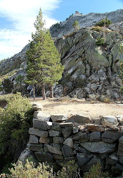
The vast majority of motorists who travel over Donner Pass use Interstate 80, which is unfortunate because the real magic of the area is on Donner Pass Road (Old Highway 40). Summit Canyon is a 260-acre jewel tucked between Donner Lake and Donner Summit. The largest tributaries to Donner Lake are located in this canyon: Summit Creek and Billy Mack Canyon Creek. A 2010 acquisition of this critical watershed by the Truckee Donner Land Trust is now part of Donner Memorial State Park and open to public access.
Summit Canyon offers season-based activities like fishing, birding, mountain biking, camping, rock climbing and backcountry skiing. For the casual hiker or history buff, the best part is to explore the original right-of-ways for the first roads to ever snake over Donner Pass. Forgotten trails like the Dutch Flat-Donner Lake Wagon Road, Rutherford Highway and Highway 40 (the nation’s first coast-to-coast road) have all left their ghosts in this historic canyon.
The Summit Canyon trail partially follows the traces of these early roads built over Donner Pass. The Dutch Flat-Donner Lake Wagon Road was a toll road constructed by Central Pacific Railroad in the 1860s. The company intended to lure the lucrative stage and freight traffic that traveled between the Comstock and Sacramento. Railroad officials believed that a more direct route from Virginia City to California would monopolize mining traffic and take business from the primary commercial road via Carson Pass near South Lake Tahoe.
Railroad executives encountered fierce resistance from the company’s Chief Engineer, Theodore D. Judah, who feared the toll road’s construction would siphon money from the trans-Sierra railroad effort. The mistrust galvanized Judah’s effort to try and obtain his own East Coast investors to take over the railroad. In late 1863, Theodore Judah and his wife Anna boarded a steamer bound for Panama on the first leg of a journey to New York. Tragically, two weeks after their arrival in New York City, Judah died of yellow fever, just four months shy of his 38th birthday.
To start your tour of Summit Canyon, drive west along Donner Lake on Old Highway 40 (Donner Pass Road) past South Shore Drive and up the mountain about one-third of a mile. A trailhead with a small parking lot is on the left. It’s about 3 miles from the trailhead to Donner Pass, with a 1,000-foot elevation gain. The upper portion of the route offers gorgeous mountain scenery, ancient Indian petroglyphs and massive railroad snow sheds. Explore as little or as much as you want. Make it easier with a car shuttle and start from the top instead.
Tahoe historian Mark McLaughlin is a nationally published author and professional speaker. His award-winning books are available at local stores or at www.thestormking.com. You can reach him at mark@thestormking.com. Check out Mark’s blog: www.tahoenuggets.com.

Comments
Use the comment form below to begin a discussion about this content.
Sign in to comment